IMAGES TAKEN NEAR TO
Torrington Avenue, COVENTRY, CV4 9UT
Introduction
This page details the photographs taken nearby to Torrington Avenue, CV4 9UT by members of the Geograph project.
The Geograph project started in 2005 with the aim of publishing, organising and preserving representative images for every square kilometre of Great Britain, Ireland and the Isle of Man.

There are currently over 7.5m images from over14,400 individuals and you can help contribute to the project by visiting https://www.geograph.org.uk
Image Map
Images are licensed for reuse under creativecommons.org/licenses/by-sa/2.0
Notes
- Clicking on the map will re-center to the selected point.
- The higher the marker number, the further away the image location is from the centre of the postcode.
Image Listing (12 Images Found)
Images are licensed for reuse under creativecommons.org/licenses/by-sa/2.0
Image
Details
Distance
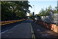
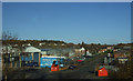
3
Wolfe Road
Wolfe Road runs south from Torrington Avenue to Charter Avenue via a narrow underbridge carrying the Coventry to Birmingham rail line.
Image: © E Gammie
Taken: 23 May 2010
0.13 miles
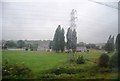
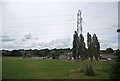
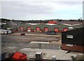
9
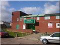
Canley Sports and Social Club
In Marler Road
Image: © Ian Rob
Taken: 25 Sep 2005
0.20 miles
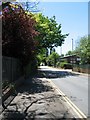
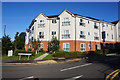
10
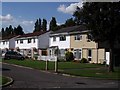
Whitchurch Way, Canley
At the junction with Wolfe Road.
Image: © John Brightley
Taken: 31 Aug 2010
0.20 miles