IMAGES TAKEN NEAR TO
Tanyard Close, COVENTRY, CV4 9TP
Introduction
This page details the photographs taken nearby to Tanyard Close, CV4 9TP by members of the Geograph project.
The Geograph project started in 2005 with the aim of publishing, organising and preserving representative images for every square kilometre of Great Britain, Ireland and the Isle of Man.

There are currently over 7.5m images from over14,400 individuals and you can help contribute to the project by visiting https://www.geograph.org.uk
Image Map
Images are licensed for reuse under creativecommons.org/licenses/by-sa/2.0
Notes
- Clicking on the map will re-center to the selected point.
- The higher the marker number, the further away the image location is from the centre of the postcode.
Image Listing (23 Images Found)
Images are licensed for reuse under creativecommons.org/licenses/by-sa/2.0
Image
Details
Distance
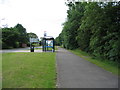
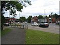
3
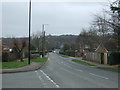
Tile Hill, road junction
The end of Tile Hill Lane; ahead, Tanner's Lane; left, Station Avenue; right, Banner Lane.
Image: © Mike Faherty
Taken: 19 Feb 2017
0.10 miles
4
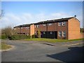
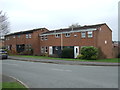
Houses off Goodman Way, Tanyard Farm estate
At the south end of Image
Image: © Richard Vince
Taken: 2 Apr 2016
0.11 miles
5
Bus stop on Banner Lane
But not just any bus stop. The orange glowing letters inside the stop tell you how long you've got to wait for the next bus.
Image: © E Gammie
Taken: 19 Jun 2010
0.11 miles
6
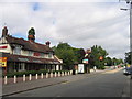
Tile Hill, Coventry
Looking up Station Road towards the shops at the crossroads with Tile Hill Lane. On the left is the Bell Inn.
Image: © David Stowell
Taken: 29 Aug 2005
0.11 miles
7
Tile Hill, Coventry
Looking east along Tile Hill Lane as is enters the woods from the crossroads with Station Road. The area around this road junction supports the local shops and services.
Image: © David Stowell
Taken: 29 Aug 2005
0.11 miles
8
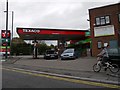
Tile Hill Service Station
On the corner of Station Avenue and Tile Hill Lane.
Image: © Ian Rob
Taken: 11 May 2013
0.11 miles
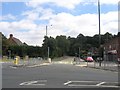
9
Crossroads, Tile Hill
The junction of Banner Lane, foreground, Tile Hill Lane, left, Tanners Lane, right and Station Avenue, ahead. Near left is one of the concrete blocks left over from WWII defences. Across the road on the right is the sad shell of an HSBC bank (once known as Midland Bank). The claims to be a 'local' bank don't apply here.
Image: © E Gammie
Taken: 19 Jun 2010
0.12 miles
10
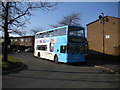
Bus in turning circle, Tanyard Farm estate
National Express Coventry 4419, a Volvo B7TL/Alexander ALX400, lays over in the turning circle on Goodman Way before making a long cross city journey to Victoria Farm estate.
Image: © Richard Vince
Taken: 2 Apr 2016
0.12 miles