IMAGES TAKEN NEAR TO
Westcotes, COVENTRY, CV4 9BG
Introduction
This page details the photographs taken nearby to Westcotes, CV4 9BG by members of the Geograph project.
The Geograph project started in 2005 with the aim of publishing, organising and preserving representative images for every square kilometre of Great Britain, Ireland and the Isle of Man.

There are currently over 7.5m images from over14,400 individuals and you can help contribute to the project by visiting https://www.geograph.org.uk
Image Map
Images are licensed for reuse under creativecommons.org/licenses/by-sa/2.0
Notes
- Clicking on the map will re-center to the selected point.
- The higher the marker number, the further away the image location is from the centre of the postcode.
Image Listing (11 Images Found)
Images are licensed for reuse under creativecommons.org/licenses/by-sa/2.0
Image
Details
Distance
1
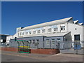
Factory and bus stop, Torrington Avenue
Torrington Avenue houses a mix of industrial and residential units.
Image: © E Gammie
Taken: 23 May 2010
0.08 miles
2
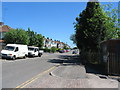
Torrington Avenue
Short terraces of 1920s/30s houses on the north side of the east end of Torrington Avenue. The south side is mainly industrial units.
Image: © E Gammie
Taken: 23 May 2010
0.09 miles
3
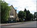
St James' Church, Tile Hill Lane
The church building dates from 1937.
Image: © E Gammie
Taken: 19 Jun 2010
0.20 miles
4
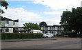
Tile Hill Lane
Prefabricated houses, erected by Coventry Corporation in 1965.
Image: © E Gammie
Taken: 19 Jun 2010
0.20 miles
5
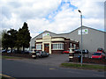
Factory unit, Torrington Avenue
An art deco entrance to Kite Packaging.
See also http://www.geograph.org.uk/photo/2061770
Image: © E Gammie
Taken: 16 Apr 2012
0.20 miles
6
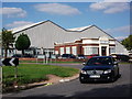
Kite Packaging, Torrington Avenue, Tile Hill
The art deco entrance to the headquarters of Kite Packaging, at the junction of Torrington Avenue and Templar Avenue. http://www.kitepackaging.co.uk/
The photo also shows the present condition of the road around this roundabout - very poor, unfortunately, as are many of Coventry's roads at the moment.
Image: © John Brightley
Taken: 31 Aug 2010
0.21 miles
8
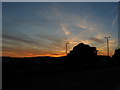
Sunset over Earlplace business park
Just before sunset on the longest day of the year. The cloud effects are mostly decaying con-trails from planes heading for/leaving Birmingham airport, Elmdon. Time 21:31. Sunset 21:34.
Image: © E Gammie
Taken: 21 Jun 2010
0.23 miles
9
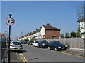
Standard Avenue
Early 20th century terraced housing.
Image: © E Gammie
Taken: 12 May 2016
0.25 miles