
IMAGES TAKEN NEAR TO
Bronze View, COVENTRY, CV4 8HR
Introduction
This page details the photographs taken nearby to Bronze View, CV4 8HR by members of the Geograph project.
The Geograph project started in 2005 with the aim of publishing, organising and preserving representative images for every square kilometre of Great Britain, Ireland and the Isle of Man.

There are currently over 7.5m images from over14,400 individuals and you can help contribute to the project by visiting https://www.geograph.org.uk
Image Map
Images are licensed for reuse under creativecommons.org/licenses/by-sa/2.0
Notes
- Clicking on the map will re-center to the selected point.
- The higher the marker number, the further away the image location is from the centre of the postcode.
Image Listing (7 Images Found)
Images are licensed for reuse under creativecommons.org/licenses/by-sa/2.0
Image
Details
Distance
1

Quantum Business
At the side of Charter Avenue is the business called Quantum. It produces car seating according to their web site.
Image: © Malcolm Neal
Taken: 7 Nov 2018
0.15 miles
2
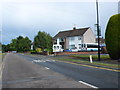
Houses on Charter Avenue
This pair of semi-detached houses is on the south side of Charter Avenue close to the junction with Dalmeny Road.
Image: © Nigel Mykura
Taken: 11 Jun 2011
0.18 miles
3
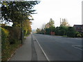
Westwood Heath Road
Westward Heath came within the Coventry boundary with the 1928 boundary extensions. However it remained largely rural until the last quarter of the 20th century, when housing and a business park were constructed.
Image: © E Gammie
Taken: 13 Nov 2011
0.19 miles
4
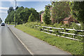
Westwood Heath Road
On the very south west edge of Coventry close to the Westwood Business Park all the houses are to the north (right) of the road with fields to the south (left).
Image: © Malcolm Neal
Taken: 1 Jun 2018
0.21 miles
5
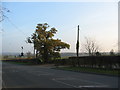
Westwood Heath Road
Westwood Heath Road runs along the boundary between Coventry And Warwickshire. At this point, there is housing to the left with open vistas over Warwickshire farmland. Once a quiet backwater, the road has become a bit of a race track in recent years hence the solar-power assisted 30mph warning signs, one of which is visible to the left of the oak which stands at the lane entrance to Lodge Farm.
Image: © E Gammie
Taken: 13 Nov 2011
0.21 miles
6
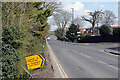
Cromwell Lane, Tile Hill
A sign points into Charter Avenue to the Xcel leisure centre where covid-19 tests for anyone displaying no symptoms are available. The facility was set up in February 2021.
Image: © Stephen McKay
Taken: 14 Apr 2021
0.23 miles
7
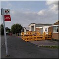
Falkland Close, Charter Avenue Industrial Estate, Canley
A listing, disused bus stop, the wares of a steel fabricator outside their workshop: this is an industrial estate at the western end of Canley.
Image: © A J Paxton
Taken: 7 Oct 2023
0.25 miles