IMAGES TAKEN NEAR TO
Charter Avenue, COVENTRY, CV4 8DZ
Introduction
This page details the photographs taken nearby to Charter Avenue, CV4 8DZ by members of the Geograph project.
The Geograph project started in 2005 with the aim of publishing, organising and preserving representative images for every square kilometre of Great Britain, Ireland and the Isle of Man.

There are currently over 7.5m images from over14,400 individuals and you can help contribute to the project by visiting https://www.geograph.org.uk
Image Map
Images are licensed for reuse under creativecommons.org/licenses/by-sa/2.0
Notes
- Clicking on the map will re-center to the selected point.
- The higher the marker number, the further away the image location is from the centre of the postcode.
Image Listing (17 Images Found)
Images are licensed for reuse under creativecommons.org/licenses/by-sa/2.0
Image
Details
Distance
1
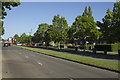
Charter Avenue
A wide residential road with ample grassy verges is Charter Avenue. The road leads to an industrial estate and Warwick University.
Image: © Malcolm Neal
Taken: 26 May 2017
0.04 miles
3
South on Mitchell Avenue (north of Charter Avenue), Canley, Coventry
It looks at first sight like dual carriageway but it isn't. The road on the right gives access to properties only. Mitchell Avenue looks like a road that never went as far as it was meant to. Templar Avenue north of the railway is a similar stub. Connected, they might have formed a north-south route west of the city centre. Pure speculation of course.
Image: © Robin Stott
Taken: 3 Aug 2013
0.12 miles
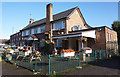
7
Canley, The Sovereign
Suburban pub on Charter Avenue.
Image: © Mike Faherty
Taken: 7 Feb 2015
0.20 miles
8
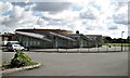
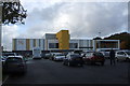
Charter Primary School, Canley Children?s Centre, Mitchell Avenue, Canley, Coventry
A Coventry City Council school. The sign at the gate carries the 'Sure Start' and NHS Coventry logos.
Image: © Robin Stott
Taken: 3 Aug 2013
0.20 miles
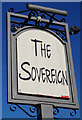
9
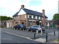
The Sovereign Public House
Probably built in the 1960's this pub is on the north side of Charter Avenue between a church and a row of shops.
Image: © Nigel Mykura
Taken: 11 Jun 2011
0.21 miles
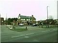
10
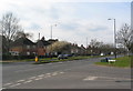
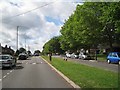
Charter Avenue, Canley
At the junction with Sheriff Avenue. The semis alongside the dual carriageway were originally council housing.
Image: © E Gammie
Taken: 26 Feb 2016
0.21 miles