
IMAGES TAKEN NEAR TO
Falkland Close, COVENTRY, CV4 8AU
Introduction
This page details the photographs taken nearby to Falkland Close, CV4 8AU by members of the Geograph project.
The Geograph project started in 2005 with the aim of publishing, organising and preserving representative images for every square kilometre of Great Britain, Ireland and the Isle of Man.

There are currently over 7.5m images from over14,400 individuals and you can help contribute to the project by visiting https://www.geograph.org.uk
Image Map
Images are licensed for reuse under creativecommons.org/licenses/by-sa/2.0
Notes
- Clicking on the map will re-center to the selected point.
- The higher the marker number, the further away the image location is from the centre of the postcode.
Image Listing (33 Images Found)
Images are licensed for reuse under creativecommons.org/licenses/by-sa/2.0
Image
Details
Distance
1
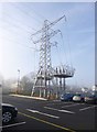
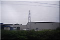
Tile Hill, pylon
Next to the car park at Image; as the overhead power lines seem to stop here, they are presumably routed underground to cross the railway lines.
Image: © Mike Faherty
Taken: 16 Feb 2013
0.06 miles
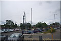
3
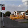
Falkland Close, Charter Avenue Industrial Estate, Canley
A listing, disused bus stop, the wares of a steel fabricator outside their workshop: this is an industrial estate at the western end of Canley.
Image: © A J Paxton
Taken: 7 Oct 2023
0.07 miles
4
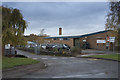
Quantum Business
At the side of Charter Avenue is the business called Quantum. It produces car seating according to their web site.
Image: © Malcolm Neal
Taken: 7 Nov 2018
0.10 miles
5
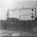
Tile Hill Station, Coventry
Another level crossing that has now departed (see Image]), and the platform architecture upgraded.
Image: © Michael Westley
Taken: Unknown
0.11 miles
6
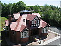
Bungalow, Tile Hill
Looking remarkably like a model construction kit in the bright sunlight, this is a complete rebuild of a bungalow that stood here for many years and was for some time in a ruinous state. I'm not sure if the original was this big or had as many dormers, but it certainly had a 'gazebo' construction on the roof.
Image: © E Gammie
Taken: 23 May 2010
0.11 miles
7
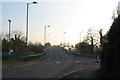
Road bridge at Tile Hill Station
The road overbridge replaced a level crossing when improvements were made to the West Coast Main Line in 2005. Here is the Station Avenue approach, with Duggins Lane junction to the right.
Image: © E Gammie
Taken: 13 Nov 2011
0.11 miles
8
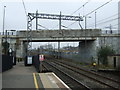
Cromwell Lane bridge over railway near Tile Hill Railway Station
Looking east on Platform 2.
Image: © JThomas
Taken: 11 Mar 2017
0.11 miles
10
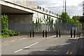
Former Tile Hill Level Crossing
There was a level crossing here by Tile Hill Station until 2004 when it was replaced by the bridge on the left. This was one of three level crossings removed to improve performance on the busy Birmingham - Coventry line.
Image: © Stephen McKay
Taken: 14 Jul 2017
0.12 miles