IMAGES TAKEN NEAR TO
Riverford Croft, COVENTRY, CV4 7HB
Introduction
This page details the photographs taken nearby to Riverford Croft, CV4 7HB by members of the Geograph project.
The Geograph project started in 2005 with the aim of publishing, organising and preserving representative images for every square kilometre of Great Britain, Ireland and the Isle of Man.

There are currently over 7.5m images from over14,400 individuals and you can help contribute to the project by visiting https://www.geograph.org.uk
Image Map
Images are licensed for reuse under creativecommons.org/licenses/by-sa/2.0
Notes
- Clicking on the map will re-center to the selected point.
- The higher the marker number, the further away the image location is from the centre of the postcode.
Image Listing (39 Images Found)
Images are licensed for reuse under creativecommons.org/licenses/by-sa/2.0
Image
Details
Distance
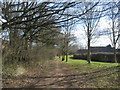
1
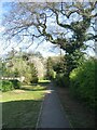
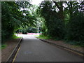
Path to Kenilworth Road
The path to Kenilworth Road from Heycroft and The Shrubberies follows the line of an old bridle route between Canley hamlet and Kenilworth Road, shown on old 6" Ordnance Survey maps.
Image: © E Gammie
Taken: 24 Apr 2021
0.06 miles
2
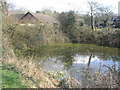
Pond by Heycroft
A curiously circular and steep-sided pond near Heycroft.
Image: © E Gammie
Taken: 25 Mar 2018
0.06 miles
3
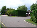
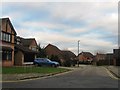
Abberton Way
Only the very western end of this small cul de sac residential road is in this square. The main section to the east is in SP3175. The road is off the Kenilworth Rd between Gibbet Hill and Kenpas Highway.
Image: © Nigel Mykura
Taken: 13 Aug 2010
0.06 miles
4
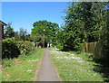
Path off Abberton Way
A good display of daisies in the cut-through between Abberton Way and The Shrubberies.
Image: © E Gammie
Taken: 23 May 2010
0.07 miles
5
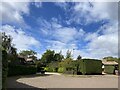
Secluded housing
Secluded housing near the A429.
Image: © Alan Hughes
Taken: 25 Sep 2021
0.07 miles
8
Abberton Way
This is a short cul de sac residential road hidden in the woods on the western side of the Kenilworth Rd between Gibbet Hill and Kenpas Highway. This is the view east towards its junction with the main road.
Image: © Nigel Mykura
Taken: 13 Aug 2010
0.10 miles
9
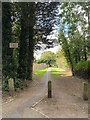
Footpath past The Galliards
A footpath leading up to Heycroft past The Galliards cul-de-sac on the right. A track following the approximate course of this path is shown as a bridle route on an 1888-1913 OS six inch map.
Image: © E Gammie
Taken: 25 Mar 2018
0.12 miles
10
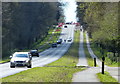
A429 Kenilworth Road towards Kenilworth
Image: © Mat Fascione
Taken: 18 Apr 2015
0.12 miles