IMAGES TAKEN NEAR TO
Old Mill Avenue, COVENTRY, CV4 7DY
Introduction
This page details the photographs taken nearby to Old Mill Avenue, CV4 7DY by members of the Geograph project.
The Geograph project started in 2005 with the aim of publishing, organising and preserving representative images for every square kilometre of Great Britain, Ireland and the Isle of Man.

There are currently over 7.5m images from over14,400 individuals and you can help contribute to the project by visiting https://www.geograph.org.uk
Image Map
Images are licensed for reuse under creativecommons.org/licenses/by-sa/2.0
Notes
- Clicking on the map will re-center to the selected point.
- The higher the marker number, the further away the image location is from the centre of the postcode.
Image Listing (33 Images Found)
Images are licensed for reuse under creativecommons.org/licenses/by-sa/2.0
Image
Details
Distance
1
Green space by Canley Brook
An entrance from Old Mill Avenue to the open space by Canley Brook.
Image: © E Gammie
Taken: 24 Feb 2019
0.06 miles
2
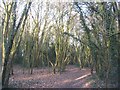
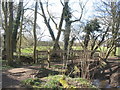
Woodland near Canley Brook
A narrow strip of scrubby woodland alongside Canley Brook.
Image: © E Gammie
Taken: 24 Feb 2019
0.09 miles
3
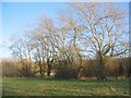
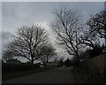
Trees alongside Canley Brook
The direction of flow is south-westward towards Warwick University campus and Kenilworth.
Image: © E Gammie
Taken: 24 Feb 2019
0.11 miles
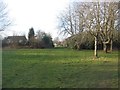
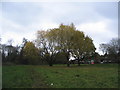
4
The Shrubberies, green space
A fine afternoon following a foggy morning. The ground is saturated after receiving unusually high rainfall amounts during January and the beginning of February.
Image: © E Gammie
Taken: 6 Feb 2021
0.12 miles
5
Footbridge over Canley Brook
The wooden bridge carries the footpath between two areas of housing on either side of the stream.
Image: © E Gammie
Taken: 25 Mar 2018
0.13 miles
6
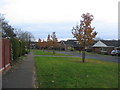
Aldrin Way, leading to Collins Grove
A small area of Canley named after two of the Apollo 11 astronauts, Buzz Aldrin and Michael Collins.
Image: © E Gammie
Taken: 27 Nov 2016
0.14 miles
7
Aldrin Way and Lunar Close
Looking along Aldrin Way, with Lunar Close off to the right. A small area of Canley named after Buzz Aldrin, Apollo 11 lunar module pilot.
Image: © E Gammie
Taken: 27 Nov 2016
0.14 miles
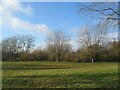
8
Green space near The Shrubberies
A green between Canley brook and The Shrubberies.
Image: © E Gammie
Taken: 27 Nov 2016
0.14 miles
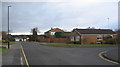
9
Near Bransford Avenue
A cycle and pedestrian link between Cannon Hill Road and Bransford Avenue
Image: © E Gammie
Taken: 5 Dec 2015
0.15 miles
10
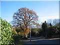
Oak, Cannon Hill Road
An old style telegraph pole with decorative finial in the foreground.
Image: © E Gammie
Taken: 28 Nov 2016
0.15 miles