
IMAGES TAKEN NEAR TO
Beverly Drive, COVENTRY, CV4 7DJ
Introduction
This page details the photographs taken nearby to Beverly Drive, CV4 7DJ by members of the Geograph project.
The Geograph project started in 2005 with the aim of publishing, organising and preserving representative images for every square kilometre of Great Britain, Ireland and the Isle of Man.

There are currently over 7.5m images from over14,400 individuals and you can help contribute to the project by visiting https://www.geograph.org.uk
Image Map
Images are licensed for reuse under creativecommons.org/licenses/by-sa/2.0
Notes
- Clicking on the map will re-center to the selected point.
- The higher the marker number, the further away the image location is from the centre of the postcode.
Image Listing (27 Images Found)
Images are licensed for reuse under creativecommons.org/licenses/by-sa/2.0
Image
Details
Distance
1
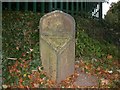
Old Boundary Marker by Stoneleigh Road, Gibbet Hill, Coventry Parish
Parish Boundary Marker by the UC road, in parish of Coventry (Coventry District), Stoneleigh Road, against North West end of railway bridge parapet.
Surveyed
Milestone Society National ID: WA_COVST1pb
Image: © Milestone Society
Taken: Unknown
0.10 miles
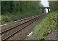
3
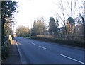
Stoneleigh Road
The bridge on Stoneleigh Road over the Coventry to Leamington railway line. This road was a quiet single track lane until the 1970s when it was widened to accommodate traffic between Warwick University and the A46. Expensive mid 20th century houses in a variety of styles stand set back from the road on either side as far as the Coventry boundary.
Image: © E Gammie
Taken: 6 Dec 2008
0.11 miles
5
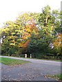
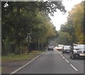
Trees on Kenilworth Road (A429)
Gateposts mark the entrances to houses hidden behind the trees.
Image: © E Gammie
Taken: 2 Nov 2007
0.12 miles
6
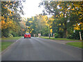
Gibbet Hill : Stoneleigh Road
The road heads out from Coventry.
Image: © Lewis Clarke
Taken: 25 Sep 2021
0.13 miles
7
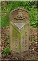
Old boundary marker
The text on the top of the marker reads: "The boundary of the city was extended to this point April 1st 1928 - Fred Lee Mayor"
Image: © Keith Williams
Taken: 2 May 2008
0.16 miles
8
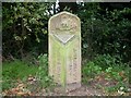
Old Boundary Marker by the A429, Kenilworth Road, Coventry parish
Parish Boundary Marker by the A429, in parish of Coventry (Coventry District), Kenilworth Road, 100m South of junction with Gibbet Hill Road, on verge, Northwest side of the road, between the drives for Nos. 138a and 140.
Inscription reads vertically:-
: STONELIGH / PARISH : : {coat of arms} : : CITY OF / COVENTRY :
Surveyed
Milestone Society National ID: WA_COVST2pb
Image: © Milestone Society
Taken: Unknown
0.17 miles
9
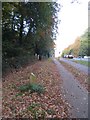
A429 Kenilworth Road
Looking towards the crossroads with Gibbet Hill and Stoneleigh Road. In the foreground is a marker of the boundary between Stoneleigh Parish and Coventry City at the time of the 1928 boundary extension which trebled the area of the city of Coventry from 4,147 to 12,878 acres.
Image: © E Gammie
Taken: 2 Nov 2007
0.17 miles
10
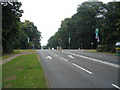
Gibbet Hill Crossroads
The junction of Gibbet Hill Road (running left to right) with the Kenilworth Road, seen heading off into the distance towards Coventry.
Image: © David Stowell
Taken: 23 Jul 2005
0.17 miles