
IMAGES TAKEN NEAR TO
Stareton Close, COVENTRY, CV4 7AU
Introduction
This page details the photographs taken nearby to Stareton Close, CV4 7AU by members of the Geograph project.
The Geograph project started in 2005 with the aim of publishing, organising and preserving representative images for every square kilometre of Great Britain, Ireland and the Isle of Man.

There are currently over 7.5m images from over14,400 individuals and you can help contribute to the project by visiting https://www.geograph.org.uk
Image Map
Images are licensed for reuse under creativecommons.org/licenses/by-sa/2.0
Notes
- Clicking on the map will re-center to the selected point.
- The higher the marker number, the further away the image location is from the centre of the postcode.
Image Listing (234 Images Found)
Images are licensed for reuse under creativecommons.org/licenses/by-sa/2.0
Image
Details
Distance
1
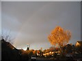
Cannon Close
A faint rainbow and evening sunlight on a silver birch. Detached houses of varying 20th century dates from the 1930s onward.
Image: © E Gammie
Taken: 12 Nov 2018
0.07 miles
2
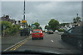
Rain and traffic on the A45
Some of the less enjoyable aspects of driving, in this case on Coventry's outer ring road.
Image: © Bill Boaden
Taken: 26 Jun 2015
0.07 miles
3
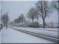
Fletchamstead Highway
Snow falling steadily had accumulated to over 10cms depth by this time and continued to fall into the evening, although not greatly increasing in depth.
Image: © E Gammie
Taken: 10 Dec 2017
0.08 miles
4
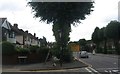
Shared use path, A45 Fletchamstead Highway
At the junction with Cannon Close. Shared use: pedestrians and cyclists share with trees; telegraph poles; streetlights; road signs; a bus stop; assorted random temporary signs and several dropped kerbs.
Image: © E Gammie
Taken: 10 Jul 2020
0.09 miles
5
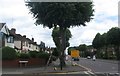
Shared use path, A45 Fletchamstead Highway
At the junction with Cannon Close. Shared use: pedestrians and cyclists share with trees; telegraph poles; streetlights; road signs; a bus stop; assorted random temporary signs and several dropped kerbs. Visibility had improved since the morning : Image The temporary signs warn of imminent surface dressing work, i.e. gravel spattering.
Image: © E Gammie
Taken: 10 Jul 2020
0.09 miles
6
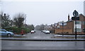
Cannon Park Road
Looking across Fletchamstead Highway (A45) to Cannon Park Road. The houses on the left were built c. 1930s facing an open space the length of the road. The group of houses on the right were added at the highway end c. 1960s. The rest of the right hand side of the road remains undeveloped.
Image: © E Gammie
Taken: 29 Jan 2015
0.09 miles
7
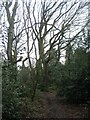
Stivichall Common
Woodland on Stivichall Common, showing the prevalence of holly in the understorey.
Image: © E Gammie
Taken: 16 Jan 2021
0.09 miles
9
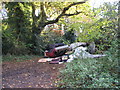
Fly-tipped rubbish, Stivichall Common
Illegally tipped rubbish on Stivichall Common near Canley Ford. Happily the local council clearance team was on the ball and it had been removed by the next afternoon ( Image] ).
Image: © E Gammie
Taken: 21 Nov 2013
0.11 miles
10
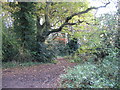
Stivichall Common woodland
Yesterday this scene was sunnier but marred by illegally fly-tipped rubbish ( Image] ).
Image: © E Gammie
Taken: 22 Nov 2013
0.11 miles