IMAGES TAKEN NEAR TO
Shepherds Hill, SOUTHAM, CV47 1GD
Introduction
This page details the photographs taken nearby to Shepherds Hill, CV47 1GD by members of the Geograph project.
The Geograph project started in 2005 with the aim of publishing, organising and preserving representative images for every square kilometre of Great Britain, Ireland and the Isle of Man.

There are currently over 7.5m images from over14,400 individuals and you can help contribute to the project by visiting https://www.geograph.org.uk
Image Map
Images are licensed for reuse under creativecommons.org/licenses/by-sa/2.0
Notes
- Clicking on the map will re-center to the selected point.
- The higher the marker number, the further away the image location is from the centre of the postcode.
Image Listing (22 Images Found)
Images are licensed for reuse under creativecommons.org/licenses/by-sa/2.0
Image
Details
Distance
2

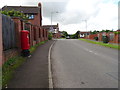
Elizabeth II postbox on Welsh Road East, Southam
Postbox No. CV47 8.
See Image] for context.
Image: © JThomas
Taken: 17 Aug 2019
0.10 miles
3
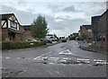
Welsh Road East, Southam
Showing position of Postbox No. CV47 8.
See Image] for postbox.
Image: © JThomas
Taken: 17 Aug 2019
0.11 miles
5
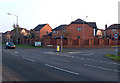
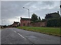
Southam, Welsh Road East
The A425 road just to the east of Southam looking towards Daventry. The road on the right of the picture is Welsh Road, an ancient drovers' road, which leads to Priors Marston and Hellidon. It is also now the access road to a large housing development.
Image: © Andy F
Taken: 30 Dec 2008
0.12 miles
6
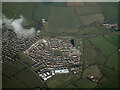
Flying Fields housing development from the air
A Taylor-Wimpey development at Southam. Viewed from a Birmingham bound flight from Prague.
Image: © Thomas Nugent
Taken: 11 Feb 2022
0.13 miles
8
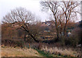
Southam to Tomlow bridleway (1 of 19)
The public bridleway and footpath from Southam to Tomlow starts just northeast of the roundabout at the intersection of the A425 and A423 roads. For the first half-mile, the path closely follows the valley of the River Stowe. This photo is looking east along the footpath with houses along the A425 in the background, their gardens running down to the river.
Next photo in series: http://www.geograph.org.uk/photo/1098882
Image: © Andy F
Taken: 30 Dec 2008
0.13 miles
9
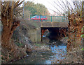
Southam, Stowe bridge
The A425 Southam to Daventry road crosses the River Stowe on this bridge just east of Southam.
Image: © Andy F
Taken: 30 Dec 2008
0.13 miles