
IMAGES TAKEN NEAR TO
Seven Meadows Road, STRATFORD-UPON-AVON, CV37 9LE
Introduction
This page details the photographs taken nearby to Seven Meadows Road, CV37 9LE by members of the Geograph project.
The Geograph project started in 2005 with the aim of publishing, organising and preserving representative images for every square kilometre of Great Britain, Ireland and the Isle of Man.

There are currently over 7.5m images from over14,400 individuals and you can help contribute to the project by visiting https://www.geograph.org.uk
Image Map
Images are licensed for reuse under creativecommons.org/licenses/by-sa/2.0
Notes
- Clicking on the map will re-center to the selected point.
- The higher the marker number, the further away the image location is from the centre of the postcode.
Image Listing (129 Images Found)
Images are licensed for reuse under creativecommons.org/licenses/by-sa/2.0
Image
Details
Distance
1
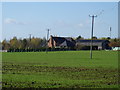
Church Farm
The farm is seen, across the field, from the river bank footpath, part of the Monarch's Way.
Image: © Michael Dibb
Taken: 6 Nov 2011
0.03 miles
2
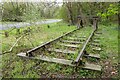
Track on the site of a former station
This railway track is beside Stratford-upon-Avon's bypass. This was the site of the former railway line which linked the town with Northamptonshire.
Image: © Philip Halling
Taken: 6 Apr 2022
0.04 miles
3
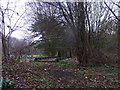
Railway relic
Now between Seven Meadows Road (A4390) and a footpath, this is a reminder of the former railway lines, which crossed here and served Stratford's second station. Goods would also have been transferred to and from the river at a wharf near Lucy's Mill. There was an agricultural merchant business nearby until the 1980s, named after the local Lucy family.
Image: © Liz Stone
Taken: 7 Jan 2013
0.06 miles
4
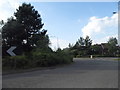
Roundabout on Seven Meadows Road, Stratford on Avon
Image: © David Howard
Taken: 3 Jun 2018
0.06 miles
6
Ripening crop at Church Farm Stratford upon Avon
Image: © Roy Hughes
Taken: 21 Jul 2021
0.08 miles
7
A4390 just north of Wetherby Way roundabout
Image: © John Firth
Taken: 22 Sep 2012
0.08 miles
8
Roundabout on Seven Meadows Road, Stratford on Avon
Image: © David Howard
Taken: 3 Jun 2018
0.08 miles
9
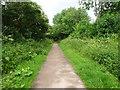
Stratford-upon-Avon Racecourse Platform railway station (site), Warwickshire
Opened in 1933 by the Great Western Railway on the line from Cheltenham to Stratford-upon-Avon, this station closed in 1966.
View north towards Stratford-upon-Avon. The station had wooden platforms and was very basic as all users were expected to be going to the races. No trace survives. The track-bed is now a path and bridleway. A short way behind the camera position, two old railway carriages served as a café and bike-hire station, at the time this image was taken.
Image: © Nigel Thompson
Taken: 19 Jun 2019
0.10 miles
10
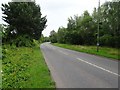
Stratford-upon-Avon Old Town railway station (site), Warwickshire
Opened in 1873 by the Stratford-upon-Avon & Midland Junction Railway on the line from Stratford to Towcester, this station closed to passengers in 1952 and completely in 1965.
View east towards Ettington and Towcester. No trace remains.
Image: © Nigel Thompson
Taken: 19 Jun 2019
0.12 miles