IMAGES TAKEN NEAR TO
St. Marys Road, STRATFORD-UPON-AVON, CV37 6TL
Introduction
This page details the photographs taken nearby to St. Marys Road, CV37 6TL by members of the Geograph project.
The Geograph project started in 2005 with the aim of publishing, organising and preserving representative images for every square kilometre of Great Britain, Ireland and the Isle of Man.

There are currently over 7.5m images from over14,400 individuals and you can help contribute to the project by visiting https://www.geograph.org.uk
Image Map
Images are licensed for reuse under creativecommons.org/licenses/by-sa/2.0
Notes
- Clicking on the map will re-center to the selected point.
- The higher the marker number, the further away the image location is from the centre of the postcode.
Image Listing (26 Images Found)
Images are licensed for reuse under creativecommons.org/licenses/by-sa/2.0
Image
Details
Distance
1
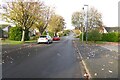
Blackthorn Road
Blackthorn Road on a late 1960s/early 1970s housing estate on the northern fringe of Stratford-upon-Avon.
Image: © Philip Halling
Taken: 31 Oct 2022
0.10 miles
2
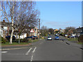
Blue Cap Road
Looking uphill from Walkers Road.
Image: © Alan Murray-Rust
Taken: 6 Mar 2011
0.11 miles
3
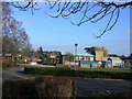
Thomas Jolyffe Primary School
Serving some of the northern residential area of Stratford.
Image: © Alan Murray-Rust
Taken: 6 Mar 2011
0.12 miles
4
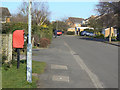
Blue Cap Road
Looking northeast from Blackthorn Road. This section of the road is still identified on OS maps as a footpath right of way. The postbox is named as Blue Cap Lane ref. CV37 102.
Image: © Alan Murray-Rust
Taken: 6 Mar 2011
0.12 miles
5
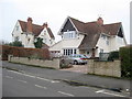
Detached Houses Maidenhead Rd
These impressive detached houses are the last two on the northern edge of Stratford before the open countryside around Clopton Tower. The road terminates in a cul de sac just north of here.
Image: © Nigel Mykura
Taken: 12 Feb 2012
0.14 miles
6
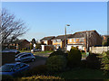
Swift Road
Late 20th century development on the slopes of Clopton Hill.
Image: © Alan Murray-Rust
Taken: 6 Mar 2011
0.16 miles
7
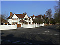
House on the corner of Benson Road
The northern end of Maidenhead Road is largely developed with large detached properties from the inter-war period onwards.
Image: © Alan Murray-Rust
Taken: 6 Mar 2011
0.17 miles
8
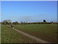
Footpath to The Dingles
This does not appear as a formal right of way, although clearly now an official footpath judging by the hard surfacing.
Image: © Alan Murray-Rust
Taken: 6 Mar 2011
0.17 miles
9
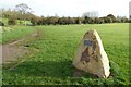
Rowley Fields
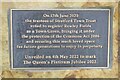
Memorial stone marking the farm that this land is now protected as common land marking Queen Elizabeth II's Platinum Jubilee.
Image: © Philip Halling
Taken: 31 Oct 2022
0.19 miles