
IMAGES TAKEN NEAR TO
Woodlands Road, STRATFORD-UPON-AVON, CV37 0DH
Introduction
This page details the photographs taken nearby to Woodlands Road, CV37 0DH by members of the Geograph project.
The Geograph project started in 2005 with the aim of publishing, organising and preserving representative images for every square kilometre of Great Britain, Ireland and the Isle of Man.

There are currently over 7.5m images from over14,400 individuals and you can help contribute to the project by visiting https://www.geograph.org.uk
Image Map
Images are licensed for reuse under creativecommons.org/licenses/by-sa/2.0
Notes
- Clicking on the map will re-center to the selected point.
- The higher the marker number, the further away the image location is from the centre of the postcode.
Image Listing (8 Images Found)
Images are licensed for reuse under creativecommons.org/licenses/by-sa/2.0
Image
Details
Distance
1
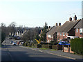
Justins Avenue
Part of the large post-war residential development in the north of the town.
Image: © Alan Murray-Rust
Taken: 6 Mar 2011
0.11 miles
2
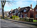
Justins Avenue
These 1940s mock Tudor terraced houses are in Justins Avenue off the Birmingham Rd close to the junction with Elm Rd.
Image: © Nigel Mykura
Taken: 6 Mar 2011
0.14 miles
3
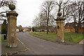
Marooned
Entrance gates to Clopton House estate now marooned among housing in Stratford upon Avon. Development has crept into the grounds of the house, which is itself now turned into flats. Clopton Road, which passes through the gates shown here, is now lined with housing estates and commercial developments but used to be the carriage drive to the house.
Image: © Colin Craig
Taken: 3 Mar 2009
0.17 miles
4
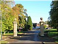
Old entrance gate posts to Clopton House
Looking NNE up Clopton Road towards its junction with Verney Drive on the left. These posts are remnants of the old Clopton House estate. This was the entrance drive to the house which is at Image
Image: © David P Howard
Taken: 20 Oct 2010
0.17 miles
5
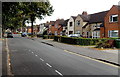
Justins Avenue, Stratford-upon-Avon
Looking NE from near the A3400 Birmingham Road junction.
Image: © Jaggery
Taken: 24 Aug 2014
0.18 miles
6
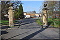
Former gate piers to Clopton Park
This pair of stone gate piers are all that remains of the former gated entrance to Clopton Park, the housing development crept into the parkland some forty years ago. The piers date from the late 17th century and are Grade II listed.
Historic England description
Gatepier approx 20m south of Verney Drive. Late C17. Ashlar on coursed limestone base. Pier with rebated angles has entablature and ball finial. Inner face to east has niche with impost band and shell vault; north face has tall round-headed recess. The pier formed part of the entrance to Clopton Park, but with the other pier is now surrounded by a late C20 housing estate. (Buildings of England: Pevsner N: Warwickshire: Harmondsworth: 1966-: 234).
Source: https://www.historicengland.org.uk/listing/the-list/list-entry/1204765
Image: © Philip Halling
Taken: 6 Mar 2011
0.20 miles
7
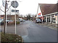
Road past the entrance to Tesco on Birmingham Road
Image: © Helen Steed
Taken: 12 Jan 2013
0.22 miles
8
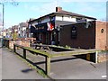
Yard Of Ale Pub, Stratford on Avon
Justins Avenue is a residential road on the north side of the Birmingham Rd and the Yard of Ale, a dog-eared modern pub with a late 20th C look about it, is close to the Junction of the two roads. It is described by CAMRA as "A modern pub just off the Birmingham Road, with a multi-generational local trade. Pool table and wide-screen TV for sports fans, and occasional live music or Karaoke evenings. Real ale returned in January 2007."
Image: © Nigel Mykura
Taken: 6 Mar 2011
0.25 miles