
IMAGES TAKEN NEAR TO
Leamington Road, COVENTRY, CV3 6GG
Introduction
This page details the photographs taken nearby to Leamington Road, CV3 6GG by members of the Geograph project.
The Geograph project started in 2005 with the aim of publishing, organising and preserving representative images for every square kilometre of Great Britain, Ireland and the Isle of Man.

There are currently over 7.5m images from over14,400 individuals and you can help contribute to the project by visiting https://www.geograph.org.uk
Image Map
Images are licensed for reuse under creativecommons.org/licenses/by-sa/2.0
Notes
- Clicking on the map will re-center to the selected point.
- The higher the marker number, the further away the image location is from the centre of the postcode.
Image Listing (72 Images Found)
Images are licensed for reuse under creativecommons.org/licenses/by-sa/2.0
Image
Details
Distance
1
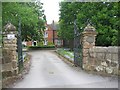
Entrance to Styvechale Manor
The building dates from the 18th century with alterations during the first half of the 19th century. It was formerly occupied by Bremond College school but has since been converted to flats.
Image: © E Gammie
Taken: 27 Apr 2020
0.03 miles
2
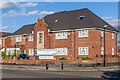
Phoenix Family Care GP Surgery
GP surgery on Leamington Road where it is met by Knoll Drive. A house is shown on the site on the 1944 6 inch map, before development of any of the surrounding roads, suggesting that the core of the building dates from the c.1930s.
Image: © Ian Capper
Taken: 24 Sep 2021
0.04 miles
3
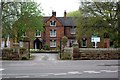
Styvechale Grange
This house was probably built around 1650, long before the more recent developments that surround it.
Image: © Keith Williams
Taken: 9 Apr 2009
0.04 miles
4
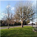
Stivichall Croft meets Leamington Road
This small triangular green fills the space between the two roads where they meet in Stivichall. We are looking towards Coventry; two of the city's three medieval spires are just visible above the traffic on Leamington Road.
Image: © A J Paxton
Taken: 8 Apr 2023
0.05 miles
5
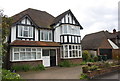
#7 Armorial Road
There is an OS benchmark Image on the right hand side of the doors of the detached garage
Image: © Roger Templeman
Taken: 3 May 2016
0.06 miles
6

Benchmark on the garage of #7 Armorial Road
Ordnance Survey cut mark benchmark described on the Bench Mark Database at http://www.bench-marks.org.uk/bm75413
Image: © Roger Templeman
Taken: 3 May 2016
0.06 miles
7
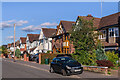
Armorial Road
Houses on a road first marked on the 1940 25 inch map.
Image: © Ian Capper
Taken: 24 Sep 2021
0.06 miles
8
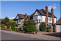
Armorial Road
Houses on a road first marked on the 1940 25 inch map.
Image: © Ian Capper
Taken: 24 Sep 2021
0.07 miles
9
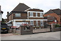
#8 Leamington Road
There is an OS benchmark Image on the front of the house, right hand corner, left of a metal gate
Image: © Roger Templeman
Taken: 3 May 2016
0.07 miles
10
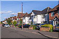
Armorial Road
Houses on a road first marked on the 1940 25 inch map.
Image: © Ian Capper
Taken: 24 Sep 2021
0.07 miles