
IMAGES TAKEN NEAR TO
Brentwood Avenue, COVENTRY, CV3 6FN
Introduction
This page details the photographs taken nearby to Brentwood Avenue, CV3 6FN by members of the Geograph project.
The Geograph project started in 2005 with the aim of publishing, organising and preserving representative images for every square kilometre of Great Britain, Ireland and the Isle of Man.

There are currently over 7.5m images from over14,400 individuals and you can help contribute to the project by visiting https://www.geograph.org.uk
Image Map
Images are licensed for reuse under creativecommons.org/licenses/by-sa/2.0
Notes
- Clicking on the map will re-center to the selected point.
- The higher the marker number, the further away the image location is from the centre of the postcode.
Image Listing (5 Images Found)
Images are licensed for reuse under creativecommons.org/licenses/by-sa/2.0
Image
Details
Distance
1
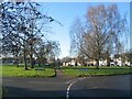
Finham Green Road and Droylsdon Park Road
Finham Green Road circles round to the south, Droylsdon Park Road to the north and they both meet up again on the far side of the green. The footpath takes the short-cut across.
Image: © E Gammie
Taken: 31 Dec 2020
0.17 miles
2
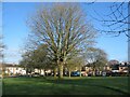
Droylsdon Park Road
Droylsdon Park Road circles round the northern edge of a small green with trees.
Image: © E Gammie
Taken: 31 Dec 2020
0.20 miles
3

The Graylands, Finham
This is a short residential road off St Martins Rd just south of the Stonebridge Highway.
Image: © Nigel Mykura
Taken: 14 Aug 2010
0.21 miles
4
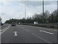
A46 south of Stivichall junction
Lane 1 ahead is a lane gain from the A45 slip road. The A46 continues as a 3-lane highway (D3 standard) from this point to the A429 Warwick exit.
Image: © Peter Whatley
Taken: 3 Apr 2012
0.24 miles
5
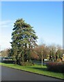
Scots pines, St Martin's Road
The group of trees include two Scots pines.
Image: © E Gammie
Taken: 31 Dec 2020
0.25 miles