
IMAGES TAKEN NEAR TO
Green Lane, COVENTRY, CV3 6EH
Introduction
This page details the photographs taken nearby to Green Lane, CV3 6EH by members of the Geograph project.
The Geograph project started in 2005 with the aim of publishing, organising and preserving representative images for every square kilometre of Great Britain, Ireland and the Isle of Man.

There are currently over 7.5m images from over14,400 individuals and you can help contribute to the project by visiting https://www.geograph.org.uk
Image Map
Images are licensed for reuse under creativecommons.org/licenses/by-sa/2.0
Notes
- Clicking on the map will re-center to the selected point.
- The higher the marker number, the further away the image location is from the centre of the postcode.
Image Listing (29 Images Found)
Images are licensed for reuse under creativecommons.org/licenses/by-sa/2.0
Image
Details
Distance
1
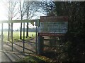
Alvis Sports and Social Club entrance, Green Lane
The club was formerly associated with the Alvis factory located on Holyhead Road, with a cricket pitch and bowling green by Four Pound Avenue alongside the factory (at Image). The sports ground re-located here when the factory was demolished and the land was redeveloped for retail and housing.
Image: © E Gammie
Taken: 31 Dec 2020
0.05 miles
2
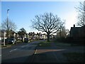
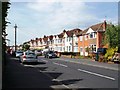
Green Lane
The boundary between Coventry and Warwickshire runs alongside much of the western side of Green Lane. Housing is mainly on the eastern side and of a style of bay-fronted 1920s/30s era semis typical of many of Coventry's suburbs.
Image: © E Gammie
Taken: 31 Dec 2020
0.08 miles
3
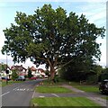
Oak tree, Green Lane
This very fine spreading oak stands on a verge on Green Lane, on the southern edge of Coventry.
Image: © A J Paxton
Taken: 19 Aug 2023
0.09 miles
4
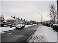
Green Lane in snow
Green Lane on a snowy day, the road has been gritted and that looking at the amount of footprints that are on the pavement there has been a lot of people out that day.
Image: © James Cobbett
Taken: 6 Jan 2010
0.09 miles
5
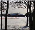
Alvis Sports Centre
The orange fence in the picture is to protect the cricket pitch.
Image: © Jane Cobbett
Taken: 7 Jan 2010
0.11 miles
7
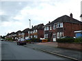
Daleway, Green Lane
Daleway runs south from Erithway to Green Lane on the south side of Kenpas Highway and is typical of the residential estates on the southern fringes of Coventry.
Image: © Nigel Mykura
Taken: 14 Aug 2010
0.16 miles
8
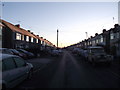
A cold and frosty morning
Inter war years housing in Erithway Road.
Image: © Anthony Vosper
Taken: 6 Dec 2014
0.17 miles
9
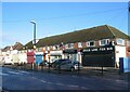
Local shops, Green Lane
In the grip of Tier 4 Covid-19 restrictions most of these shops are probably temporarily closed except, maybe, for the chemist and the fish bar. (Frankly, I've lost track).
Image: © E Gammie
Taken: 31 Dec 2020
0.18 miles
10
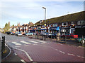
Shops and Post Office, Green Lane, Finham, Coventry
As well as the local shops there are two schools on Green Lane. The road is traffic-calmed, with a mandatory 20mph speed limit in places.
Image: © Robin Stott
Taken: 17 Dec 2012
0.18 miles