
IMAGES TAKEN NEAR TO
Leasowes Avenue, COVENTRY, CV3 6BH
Introduction
This page details the photographs taken nearby to Leasowes Avenue, CV3 6BH by members of the Geograph project.
The Geograph project started in 2005 with the aim of publishing, organising and preserving representative images for every square kilometre of Great Britain, Ireland and the Isle of Man.

There are currently over 7.5m images from over14,400 individuals and you can help contribute to the project by visiting https://www.geograph.org.uk
Image Map
Images are licensed for reuse under creativecommons.org/licenses/by-sa/2.0
Notes
- Clicking on the map will re-center to the selected point.
- The higher the marker number, the further away the image location is from the centre of the postcode.
Image Listing (22 Images Found)
Images are licensed for reuse under creativecommons.org/licenses/by-sa/2.0
Image
Details
Distance
1
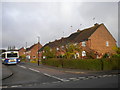
Leasowes Avenue, Finham
Seen from its junction with Benfield Avenue. The bus on the left is waiting at the terminus of route 9A to Walsgrave Hospital via Stivichall and Coventry city centre.
Image: © Richard Vince
Taken: 10 Nov 2012
0.06 miles
4
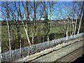
Bishop Ullathorne Catholic School and playing fields, Coventry
Seen from a Coventry-Leamington Spa train.
Image: © Robin Stott
Taken: 17 Mar 2022
0.15 miles
5
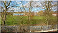
Bishop Ullathorne RC School, Coventry
Taken from the railway adjacent.
Image: © Richard Cooke
Taken: 22 Feb 2014
0.16 miles
6
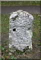
Old Milestone by the A429, Kenilworth Road, Coventry Parish
Stone post (plate lost) by the A429, in parish of COVENTRY (COVENTRY District), Kenilworth Road; between Nos 63 & 65, on grass verge, 5ft from kerb, on East side of road. Erected by the Coventry & Warwick turnpike trust in the 19th century.
Inscription once read:- : (Coventry / 2 / Warwick / 8) :
Milestone Society National ID: WA_CVWA02
Image: © Mike Faherty
Taken: 4 Oct 2008
0.19 miles
7
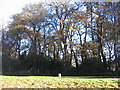
Milestone, Kenilworth Road
A milestone marker alongside Kenilworth Road (A429). It appears to have lost its distance information but would have read Coventry 2 Warwick 8 according to old Ordnance Survey 6inch maps.
Image: © E Gammie
Taken: 28 Nov 2016
0.19 miles
8
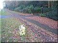
Milestone, Kenilworth Road
A white painted milestone marker alongside Kenilworth Road (A429). It has lost its distance information plate but it would have read Coventry 2 Warwick 8 according to old Ordnance Survey 6inch maps.
Image: © E Gammie
Taken: 14 Dec 2019
0.19 miles
9
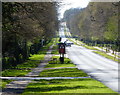
A429 Kenilworth Road towards Kenilworth
Image: © Mat Fascione
Taken: 18 Apr 2015
0.20 miles
10
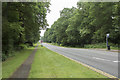
Kenilworth Road
Here you can clearly see the double yellow lines.
Image: © Malcolm Neal
Taken: 2 Jun 2018
0.20 miles