
IMAGES TAKEN NEAR TO
Warwick Road, COVENTRY, CV3 6AJ
Introduction
This page details the photographs taken nearby to Warwick Road, CV3 6AJ by members of the Geograph project.
The Geograph project started in 2005 with the aim of publishing, organising and preserving representative images for every square kilometre of Great Britain, Ireland and the Isle of Man.

There are currently over 7.5m images from over14,400 individuals and you can help contribute to the project by visiting https://www.geograph.org.uk
Image Map
Images are licensed for reuse under creativecommons.org/licenses/by-sa/2.0
Notes
- Clicking on the map will re-center to the selected point.
- The higher the marker number, the further away the image location is from the centre of the postcode.
Image Listing (670 Images Found)
Images are licensed for reuse under creativecommons.org/licenses/by-sa/2.0
Image
Details
Distance
1

Former Park Court offices site
This view will change once development begins on the cleared site of Park Court offices in the foreground. Left to right: the office tower block on the corner of Eaton Road, behind it Station Tower; flats and shops on Warwick Road. The cream building on the right is the Rocket public house, built in 1838 as the Railway Hotel. It was refurbished in the 1960's and became the Rocket to fit both the historical rail connection and the 1960's fixation with space flight.
Update 2012 : Image
Image: © E Gammie
Taken: 13 Apr 2007
0.00 miles
2
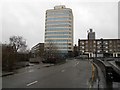
Coventry-Westminster Road
Looking towards Greyfriars House dating from c.1970.
Image: © Ian Rob
Taken: 10 Feb 2013
0.01 miles
3

Coventry-Warwick Road
The Rocket Pub and Greyfriars House.
Image: © Ian Rob
Taken: 10 Feb 2013
0.01 miles
4
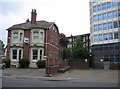
The Survivor
I presume this old town house survived the bombing of Coventry in November 1940. It is now dwarfed by modern office blocks of glass and concrete.
Image: © Mr Ignavy
Taken: 17 May 2008
0.01 miles
5

No 9 bus at Coventry Railway Station
Image: © Gerald England
Taken: 23 Sep 2021
0.02 miles
6
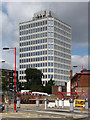
Eaton House, Eaton Road, Coventry
Distinctive office block, square with canted corners and blue-tinted windows.
My thanks to fellow Geographer, John Brightley, for letting me know that it dates from c1970, "and was originally called 'Leyland Coventry House' - it housed the main administrative functions of the many factories British Leyland had in the city at that time".
Image: © Stephen Richards
Taken: 23 Aug 2011
0.02 miles
7
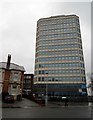
Coventry-Greyfriars House
Looking from Eaton Road.
Image: © Ian Rob
Taken: 10 Feb 2013
0.02 miles
8
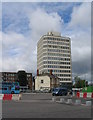
Eaton House
Eaton House, dating from c. 1970 towers over the last remaining Edwardian building on Eaton Road. To the left is the rear of flats on Warwick Road.
Image: © E Gammie
Taken: 11 Jul 2016
0.02 miles
9
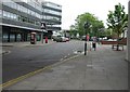
Eaton Road
Coventry railway station is in the middle distance.
Image: © Mr Ignavy
Taken: 17 May 2008
0.02 miles
