
IMAGES TAKEN NEAR TO
Chatsworth Rise, COVENTRY, CV3 5NR
Introduction
This page details the photographs taken nearby to Chatsworth Rise, CV3 5NR by members of the Geograph project.
The Geograph project started in 2005 with the aim of publishing, organising and preserving representative images for every square kilometre of Great Britain, Ireland and the Isle of Man.

There are currently over 7.5m images from over14,400 individuals and you can help contribute to the project by visiting https://www.geograph.org.uk
Image Map
Images are licensed for reuse under creativecommons.org/licenses/by-sa/2.0
Notes
- Clicking on the map will re-center to the selected point.
- The higher the marker number, the further away the image location is from the centre of the postcode.
Image Listing (45 Images Found)
Images are licensed for reuse under creativecommons.org/licenses/by-sa/2.0
Image
Details
Distance
1
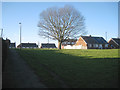
Tree in open space off Haddon End, Cheylesmore, Coventry
Chatsworth Rise is on the skyline; Bolton Close is on the left.
Image: © Robin Stott
Taken: 17 Feb 2015
0.05 miles
2
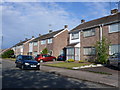
Dillotford Avenue
This is close to the eastern end of the avenue. These semi detached houses are opposite Cascade Close.
Image: © Nigel Mykura
Taken: 11 Jun 2011
0.07 miles
3
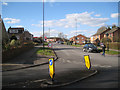
Black Prince Avenue at its junction with Leaf Lane, Cheylesmore, Coventry
Image: © Robin Stott
Taken: 17 Feb 2015
0.07 miles
4
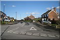
Chatsworth Rise, Stivichall, Coventry
Seen from Okehampton Road.
Image: © Robin Stott
Taken: 17 Feb 2015
0.09 miles
5
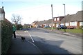
Okehampton Road, Stivichall, Coventry
One of several residential roads with Devonshire and West Country names.
Image: © Robin Stott
Taken: 17 Feb 2015
0.10 miles
6
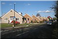
Leaf Lane, Stivichall, Coventry
Gas mains were being replaced, hence digger-wagon and traffic management on a busy suburban road.
Image: © Robin Stott
Taken: 17 Feb 2015
0.10 miles
7
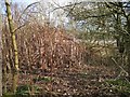
South side of a stand of Japanese knotweed by the A444, Stivichall, Coventry
An invasive and deep-rooted alien species. It's doing no apparent harm here in open space left to go wild, but in residential areas it is a serious problem, difficult to eradicate. https://www.gov.uk/prevent-the-spread-of-harmful-invasive-and-non-native-plants
Image: © Robin Stott
Taken: 17 Feb 2015
0.12 miles
8
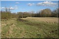
Open space between Leaf Lane and the A444, Stivichall, Coventry
A buffer between a residential area and the busy A444 dual carriageway, detectable through the trees, right. Informal access is through the tree screen to Leaf Lane, left.
Image: © Robin Stott
Taken: 17 Feb 2015
0.12 miles
9
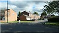
1 - 19 Forester's Road, Coventry
Semi-detached house off Arundel Road, Cheylesmore.
Image: © Christine Johnstone
Taken: 24 Sep 2021
0.12 miles
10
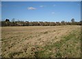
Open space buffer between the A444 and Leaf Lane, Stivichall, Coventry
Image: © Robin Stott
Taken: 17 Feb 2015
0.13 miles