
IMAGES TAKEN NEAR TO
Daventry Road, COVENTRY, CV3 5HE
Introduction
This page details the photographs taken nearby to Daventry Road, CV3 5HE by members of the Geograph project.
The Geograph project started in 2005 with the aim of publishing, organising and preserving representative images for every square kilometre of Great Britain, Ireland and the Isle of Man.

There are currently over 7.5m images from over14,400 individuals and you can help contribute to the project by visiting https://www.geograph.org.uk
Image Map
Images are licensed for reuse under creativecommons.org/licenses/by-sa/2.0
Notes
- Clicking on the map will re-center to the selected point.
- The higher the marker number, the further away the image location is from the centre of the postcode.
Image Listing (71 Images Found)
Images are licensed for reuse under creativecommons.org/licenses/by-sa/2.0
Image
Details
Distance
1
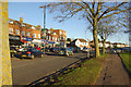
Daventry Road, Cheylesmore
On the northern side of the road is a thriving row of suburban shops, opposite Quinton Park.
Image: © Stephen McKay
Taken: 7 Dec 2012
0.02 miles
2
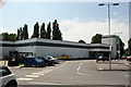
ASDA car park, Daventry Road
Ordnance Survey documents indicate that in 1958 a benchmark levelled at 76.621m above Newlyn Datum was verified on an outbuilding of the Cheylesmore Inn at this location.
Image: © Roger Templeman
Taken: 6 Jul 2017
0.03 miles
3
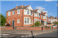
Lichfield Street
c.1920s/30s housing, some first shown on the 1940 25 inch map. Off to the left is Cornelius Street.
Image: © Ian Capper
Taken: 24 Sep 2021
0.05 miles
4
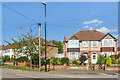
Queen Isabel's Avenue
c.1920s/30s housing, first shown on the 1940 25 inch map.
Image: © Ian Capper
Taken: 24 Sep 2021
0.06 miles
5
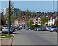
Daventry Road in Cheylesmore, Coventry
Image: © Mat Fascione
Taken: 18 Apr 2015
0.06 miles
6
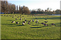
Quinton Park
Canada geese graze in Quinton Park, the remnant of a former royal hunting park, deep in the Coventry suburbs.
Image: © Stephen McKay
Taken: 7 Dec 2012
0.06 miles
7
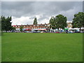
Quinton Parade
A still thriving suburban shopping parade on Daventry Road, opposite Quinton Park. A variety of shops with only one or two units empty.
Image: © E Gammie
Taken: 29 Jun 2012
0.06 miles
8
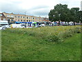
Flower bed, Quinton Park, Coventry
With a parade of shops on Daventry Road beyond.
Image: © Christine Johnstone
Taken: 24 Sep 2021
0.07 miles
9
Shops on Daventry Road, Cheylesmore
The northern fringe of Quinton Park (right) borders the opposite side of Daventry Road.
Image: © Richard Vince
Taken: 10 Nov 2012
0.07 miles
10
Shopping parade, Cheylesmore
This was built as part of the pre-war expansion of Coventry. It is amazing the difference some well maintained flower beds can make to an area!
Image: © David Stowell
Taken: 30 Jul 2005
0.09 miles