
IMAGES TAKEN NEAR TO
Daventry Road, COVENTRY, CV3 5DJ
Introduction
This page details the photographs taken nearby to Daventry Road, CV3 5DJ by members of the Geograph project.
The Geograph project started in 2005 with the aim of publishing, organising and preserving representative images for every square kilometre of Great Britain, Ireland and the Isle of Man.

There are currently over 7.5m images from over14,400 individuals and you can help contribute to the project by visiting https://www.geograph.org.uk
Image Map
Images are licensed for reuse under creativecommons.org/licenses/by-sa/2.0
Notes
- Clicking on the map will re-center to the selected point.
- The higher the marker number, the further away the image location is from the centre of the postcode.
Image Listing (78 Images Found)
Images are licensed for reuse under creativecommons.org/licenses/by-sa/2.0
Image
Details
Distance
1
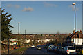
Daventry Road, Cheylesmore
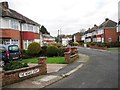
Suburban Coventry: looking down the hill at the western end of Daventry Road at a sea of semi-detached houses.
Image: © Stephen McKay
Taken: 7 Dec 2012
0.04 miles
2
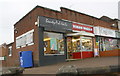
Shops on Daventry Road at Dillotford Avenue junction
There is an OS benchmark Image on the corner, left hand face, of Beauty-Ful-Nails' premises
Image: © Roger Templeman
Taken: 10 Mar 2018
0.06 miles
3
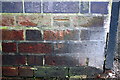
Benchmark on #50 Daventry Road
Ordnance Survey cut mark benchmark levelled at 87.167m above mean sea level
Image: © Roger Templeman
Taken: 10 Mar 2018
0.06 miles
4
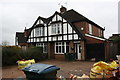
Semi detached houses on Ulverscroft Road
There is an OS benchmark Image on the side of the garage attached to the right hand house near its front corner
Image: © Roger Templeman
Taken: 10 Mar 2018
0.07 miles
5
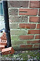
Benchmark on #2 Ulverscroft Road
Ordnance Survey cut mark benchmark described on the Bench Mark Database at http://www.bench-marks.org.uk/bm93914
Image: © Roger Templeman
Taken: 10 Mar 2018
0.07 miles
7
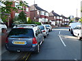
Daintree Croft
This is a small residential cul-de-sac consisting of semi detached houses from the late 1940's just off the Daventry Road. The double yellow lines seemed to be ignored.
Image: © Nigel Mykura
Taken: 11 Jun 2011
0.07 miles
8
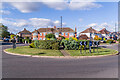
Roundabout, Daventry Road
Roundabout at the junction of Daventry Road and Ulverscroft Road. The road layout and some of the housing are first shown on the 1940 25 inch map.
Image: © Ian Capper
Taken: 24 Sep 2021
0.07 miles
9
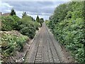
Railway line towards Coventry from Leamington Road bridge
Image: © Nigel Thompson
Taken: 24 Aug 2022
0.08 miles
10
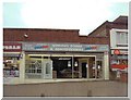
Small Parade of Shops on Daventry Road
Some years ago before the occupier changed.
Image: © David Walton
Taken: Unknown
0.09 miles