
IMAGES TAKEN NEAR TO
The Chesils, COVENTRY, CV3 5BG
Introduction
This page details the photographs taken nearby to The Chesils, CV3 5BG by members of the Geograph project.
The Geograph project started in 2005 with the aim of publishing, organising and preserving representative images for every square kilometre of Great Britain, Ireland and the Isle of Man.

There are currently over 7.5m images from over14,400 individuals and you can help contribute to the project by visiting https://www.geograph.org.uk
Image Map
Images are licensed for reuse under creativecommons.org/licenses/by-sa/2.0
Notes
- Clicking on the map will re-center to the selected point.
- The higher the marker number, the further away the image location is from the centre of the postcode.
Image Listing (22 Images Found)
Images are licensed for reuse under creativecommons.org/licenses/by-sa/2.0
Image
Details
Distance
1
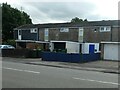
Houses on the west side of Ulverscroft Road
The newer houses on this suburban street in Coventry were built with garages, the older ones were not.
Image: © Christine Johnstone
Taken: 24 Sep 2021
0.01 miles
2
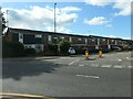
Ulverscroft Road, Coventry
Looking north from the junction with a road called The Chesils.
Image: © Christine Johnstone
Taken: 24 Sep 2021
0.02 miles
3
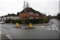
Junction of The Chesils and Arundel Road
Image: © Roger Templeman
Taken: 10 Mar 2018
0.02 miles
4
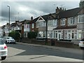
Houses on the west side of Arundel Road, Coventry
Built in blocks of four and six, after 1937.
Image: © Christine Johnstone
Taken: 24 Sep 2021
0.05 miles
5
Mr Whippy on Ulverscroft Road, Coventry
Waiting for business as the school day ends at the nearby primary school.
Image: © Christine Johnstone
Taken: 24 Sep 2021
0.08 miles
6
Dillottford Avenue
This is a long residential street with semi-detached houses on one side and terraced houses on the other. It runs from the Daventry road all the way round to Black Prince Avenue. The post box on the right is on the corner of Salisbury Avenue.
Image: © Nigel Mykura
Taken: 11 Jun 2011
0.08 miles
8
Houses on the east side of Ulverscroft Road, Coventry
Built with garages, some of which have been converted.
Image: © Christine Johnstone
Taken: 24 Sep 2021
0.09 miles
9
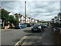
Mary Herbert Street, Coventry
Looking south from the junction with Brightwalton Road. The street was developed after 1937.
Image: © Christine Johnstone
Taken: 24 Sep 2021
0.11 miles
10
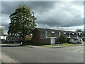
The east side of Keviliok Street, Coventry
Seen from the junction with Aruundel Road. The unbuilt Keviliok Street is shown on the 6 inch OS map surveyed in 1937, but these houses were not built until the late 1960s, or later.
Image: © Christine Johnstone
Taken: 24 Sep 2021
0.13 miles