
IMAGES TAKEN NEAR TO
Tait Way, WARWICK, CV35 9SW
Introduction
This page details the photographs taken nearby to Tait Way, CV35 9SW by members of the Geograph project.
The Geograph project started in 2005 with the aim of publishing, organising and preserving representative images for every square kilometre of Great Britain, Ireland and the Isle of Man.

There are currently over 7.5m images from over14,400 individuals and you can help contribute to the project by visiting https://www.geograph.org.uk
Image Map
Images are licensed for reuse under creativecommons.org/licenses/by-sa/2.0
Notes
- Clicking on the map will re-center to the selected point.
- The higher the marker number, the further away the image location is from the centre of the postcode.
Image Listing (31 Images Found)
Images are licensed for reuse under creativecommons.org/licenses/by-sa/2.0
Image
Details
Distance
1
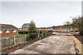
Construction entrance to Mountford Place
The construction entrance off Loxley Road, for the new housing development by Persimmon Homes, called Mountford Place, to the west of the Dovehouse estate in Wellesbourne.
Image: © David P Howard
Taken: 1 Jan 2016
0.06 miles
2
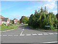
Blenheim Walk, Dovehouse Estate
Looking east up Blenheim Walk from its junction with Dovehouse Drive.
Image: © David P Howard
Taken: 20 Sep 2010
0.07 miles
3
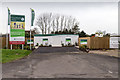
New houses off Dovehouse Drive
The marketing suite for the new housing development by Persimmon Homes, called Mountford Place, to the west of the Dovehouse estate in Wellesbourne.
Not much activity here at midday on New Year's Day.
Image: © David P Howard
Taken: 1 Jan 2016
0.07 miles
4
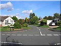
Anson Close, Dovehouse Estate
View ENE up Anson Close from its junction with Dovehouse Drive.
Image: © David P Howard
Taken: 20 Sep 2010
0.07 miles
5
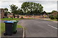
New housing off Dovehouse Drive
New houses are being built at the edge of the Dovehouse Estate.
Access for the construction equipment is off Loxley Road, but the ultimate access when the houses are finished will be here off Dovehouse Drive.
Image: © David P Howard
Taken: 9 Sep 2015
0.08 miles
6
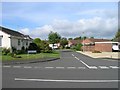
Halifax Close, Dovehouse Estate
Looking west up Halifax Close from its junction with Dovehouse Drive.
Image: © David P Howard
Taken: 20 Sep 2010
0.08 miles
7
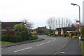
Dovehouse Drive, Dovehouse Estate
View SW along Dovehouse Drive from Cranwell Drive towards Chadley House in the distance in Image
Image: © David P Howard
Taken: 31 Dec 2009
0.08 miles
8
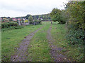
Farm track off Loxley Road
The field just through the far gate is subject to a planning proposal to build about 75 houses, adjoining the edge of the Dovehouse Estate, which can just be seen on the left hand edge of the photo.
The proposed access to these new houses would be via Oxford Way and Dovehouse Drive. There is no proposal to make a road through this small strip of land onto Loxley Road, as the junction would be too dangerous due to adverse sight lines.
Image: © David P Howard
Taken: 19 Oct 2013
0.09 miles
9
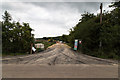
New houses off Loxley Road
The temporary entrance to a new housing site off Loxley Road.
When built, the access to the houses will be off Dovehouse Drive.
Image: © David P Howard
Taken: 9 Sep 2015
0.10 miles
10
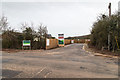
Construction entrance to Mountford Place
The construction entrance off Loxley Road, for the new housing development by Persimmon Homes, called Mountford Place, to the west of the Dovehouse estate in Wellesbourne.
Image: © David P Howard
Taken: 1 Jan 2016
0.10 miles