
IMAGES TAKEN NEAR TO
Caen Close, WARWICK, CV35 8UE
Introduction
This page details the photographs taken nearby to Caen Close, CV35 8UE by members of the Geograph project.
The Geograph project started in 2005 with the aim of publishing, organising and preserving representative images for every square kilometre of Great Britain, Ireland and the Isle of Man.

There are currently over 7.5m images from over14,400 individuals and you can help contribute to the project by visiting https://www.geograph.org.uk
Image Map
Images are licensed for reuse under creativecommons.org/licenses/by-sa/2.0
Notes
- Clicking on the map will re-center to the selected point.
- The higher the marker number, the further away the image location is from the centre of the postcode.
Image Listing (35 Images Found)
Images are licensed for reuse under creativecommons.org/licenses/by-sa/2.0
Image
Details
Distance
1
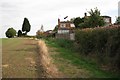
North-east edge of Hampton Magna village
With pirate flag and germinating crop
Image: © Robin Stott
Taken: 1 Oct 2009
0.02 miles
2
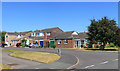
Marten Close,Hampton Magna, Budbrooke
A suburban style village on the western side of Warwick. Handy for the new Warwick Parkway station.
This is a village that's reinvented itself in the 20th century, with the village name in olde script up by the isolated parish church a short way north but only a couple of farms and houses nearby.
Budbrooke was an ancient village decimated by the Black Death in the 14th century and remained home to only a few people until the 1960s when a new housing development called Hampton Magna was built on former military land. https://en.wikipedia.org/wiki/Budbrooke
Image: © Des Blenkinsopp
Taken: 27 Jun 2018
0.05 miles
3
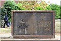
Commemorative wall, Blandford Way, Hampton Magna
The wall is set at the back of a simple circle of brick paving.
Image: © Robin Stott
Taken: 1 Oct 2009
0.10 miles
4
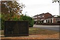
Commemorative wall, Blandford Way, Hampton Magna
It reads "Site of Budbrooke Barracks 1877-1960". The emblem to the left is of the Royal Warwickshire Regiment. Arras Boulevard continues up the hill.
Image: © Robin Stott
Taken: 1 Oct 2009
0.10 miles
5
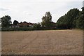
Eastern extremity of Hampton Magna village
Image: © Robin Stott
Taken: 1 Oct 2009
0.12 miles
6
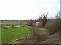
Old Budbrook Road from Warwick Parkway station
Looking SW from the station platform down Old Budbrook Road towards Hampton Magna.
Image: © David P Howard
Taken: 10 Apr 2010
0.13 miles
7
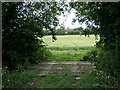
A sleeper bridge into a field near Hampton Magna
The tower of Budbrooke parish church and a field of barley are framed by hedgerow trees.
Image: © Robin Stott
Taken: 13 Jul 2009
0.15 miles
8
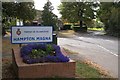
Old Budbrooke Road
At its junction with Blandford Way
Image: © Robin Stott
Taken: 1 Oct 2009
0.16 miles
9
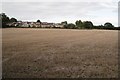
Eastern extent of Hampton Magna village, near Warwick
These houses are in Clinton Avenue.
Image: © Robin Stott
Taken: 8 Oct 2009
0.16 miles
10
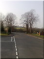
A view towards St Michael's Church, Budbrooke from Hampton Magna
A view towards St Michael's Church, Budbrooke from Hampton Magna
Image: © Anthony Morgan
Taken: 21 Mar 2009
0.17 miles