
IMAGES TAKEN NEAR TO
Scimitar Way, COVENTRY, CV3 4GA
Introduction
This page details the photographs taken nearby to Scimitar Way, CV3 4GA by members of the Geograph project.
The Geograph project started in 2005 with the aim of publishing, organising and preserving representative images for every square kilometre of Great Britain, Ireland and the Isle of Man.

There are currently over 7.5m images from over14,400 individuals and you can help contribute to the project by visiting https://www.geograph.org.uk
Image Map
Images are licensed for reuse under creativecommons.org/licenses/by-sa/2.0
Notes
- Clicking on the map will re-center to the selected point.
- The higher the marker number, the further away the image location is from the centre of the postcode.
Image Listing (44 Images Found)
Images are licensed for reuse under creativecommons.org/licenses/by-sa/2.0
Image
Details
Distance
1
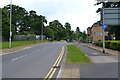
Scimitar Way, by Whitley Business Park, Coventry
Beyond the fence an area of the business park is still being developed. Mature trees were once in the grounds of Whitley Abbey. A "Can I help you?" situation developed here. There was anxiety about car number plates being photographed by the agents of competitors of Jaguar Land Rover, in order to identify visitors to JLR's engineering R&D centre nearby.
Image: © Robin Stott
Taken: 8 Jun 2016
0.02 miles
2
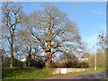
Whitley Abbey trees by Scimitar Way
Trees from the Whitley Abbey estate now stand by a 21st century road that serves business parks on the southern edge of Coventry. There is a fine mature oak in the centre; the tree in the distance at the far right, perhaps a common lime, has balls of mistletoe growing on its branches. Pond and school lie beyond. On the school, the long-vanished big house and the abbey that never was, see Image
Image: © A J Paxton
Taken: 30 Mar 2024
0.02 miles
3
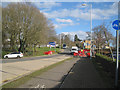
Scimitar Way, Whitley Business Park, Whitley, Coventry
The blue sign left of centre advertises industrial and office accommodation. Interesting mature trees in the distance around Whitley Abbey Comprehensive School, built on the site of Whitley Abbey.
Image: © Robin Stott
Taken: 17 Feb 2015
0.03 miles
4
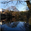
Pond by Scimitar Way, Whitley
This pond is marked as a Fish Pond on the Whitley Abbey estate on the OS Six Inch Map, 1885-1915 series. It is roughly reverse-S-shaped. The big house at Whitley was a manor house that was renamed 'Whitley Abbey' in the 19th century, though there was never a monastery here. It housed Belgian refugees during the First World War, then fell into decay. Coventry City Council built a school on the site in the 1950s; the school can be seen beyond the pond. See the Coventry Society site on Whitley https://www.coventrysociety.org.uk/coventry-neighbourhoods/whitley/ .
Image: © A J Paxton
Taken: 30 Mar 2024
0.04 miles
5
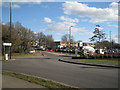
Developing business park, Whitley, Coventry
The Jaguar Landrover Centre is out of shot right. Leaf Lane goes left through woodland to Racquet Centre and Hotel. The new bridge will improve access to all this.
Image: © Robin Stott
Taken: 17 Feb 2015
0.05 miles
6
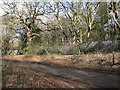
A security fence through woodland, Whitley, Coventry
The fence is to the Whitley Abbey Comprehensive School site. The road, now a cycle route to Whitley and Willenhall, may once have connected a housing estate to a works (Armstrong-Whitworth?) on the site of the present Jaguar Land Rover Engineering Centre. The woodland could have been part of the Whitley Abbey estate.
Image: © Robin Stott
Taken: 17 Feb 2015
0.09 miles
7
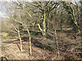
Woodland in the valley of the River Sherbourne, Whitley, Coventry
In ignorance I'm assuming that this predominantly oak woodland was once part of the Whitley Abbey estate, cut up by roads and nibbled into by a business park and a school. It appears unmanaged as woodland and unstructured as public open space but is no less interesting for that. The scene shows the colours of late winter: grey bark, fading brown leaves, rich dark green of holly, growing like a weed.
Image: © Robin Stott
Taken: 17 Feb 2015
0.11 miles
8
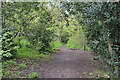
Whitley Grove at its most idyllic, southeast Coventry
Image: © Robin Stott
Taken: 30 Apr 2016
0.14 miles
10
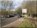
North on Leaf Lane, Whitley, Coventry
Here Leaf Lane seems to be a car park, perhaps for contractor's staff working on the new bridge over the A444. The woodland setting could be a remnant of the Whitley Abbey estate.
Leaf Lane (Howes Lane on old maps) is jolly odd. It sweeps along to the west of the A444, crosses it at Whitley Bridge, then takes a short haphazard course to a hotel and a sports centre. Was the council economising on road names?
Image: © Robin Stott
Taken: 17 Feb 2015
0.15 miles