
IMAGES TAKEN NEAR TO
London Road, COVENTRY, CV3 4EN
Introduction
This page details the photographs taken nearby to London Road, CV3 4EN by members of the Geograph project.
The Geograph project started in 2005 with the aim of publishing, organising and preserving representative images for every square kilometre of Great Britain, Ireland and the Isle of Man.

There are currently over 7.5m images from over14,400 individuals and you can help contribute to the project by visiting https://www.geograph.org.uk
Image Map
Images are licensed for reuse under creativecommons.org/licenses/by-sa/2.0
Notes
- Clicking on the map will re-center to the selected point.
- The higher the marker number, the further away the image location is from the centre of the postcode.
Image Listing (59 Images Found)
Images are licensed for reuse under creativecommons.org/licenses/by-sa/2.0
Image
Details
Distance
1
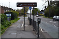
Southeast on London Road, Willenhall, southeast Coventry
The busy London Road, B4110, cuts Willenhall in half.
Image: © Robin Stott
Taken: 30 Apr 2016
0.03 miles
2
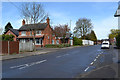
Surgery and pharmacy, Chace Lane, Willenhall, southeast Coventry
The white fence encloses the site of the Chace Centre, undergoing demolition. On the right is Dell Close.
Image: © Robin Stott
Taken: 30 Apr 2016
0.05 miles
3
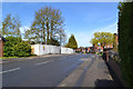
North on Chace Avenue, Willenhall, Coventry
Extensive hostel accommodation in Willenhall was first laid out in 1941 for war workers and refugees. The original site to the east of Chace Avenue, right, was redeveloped for housing in the late 1980s, I think. The hostel accommodation was replaced by the Chace Centre, latterly described as a supported living centre for homeless people. It is now in course of demolition by City Demolition, behind the white hoarding.
Image: © Robin Stott
Taken: 30 Apr 2016
0.05 miles
4
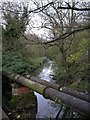
Willenhall, River Sowe
Looking upstream from Willenhall Bridge.
Image: © Mike Faherty
Taken: 21 Nov 2010
0.06 miles
5
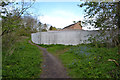
North on the Sowe Valley path past the Chace Centre site, Willenhall, southeast Coventry
The Chace Centre was being demolished. The River Sowe is down a steep bank on the left. This view is more or less the reverse of Mike Faherty's Image from 2010.
Image: © Robin Stott
Taken: 30 Apr 2016
0.07 miles
6
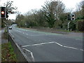
Willenhall Bridge
A three-arched stone bridge, taking London Road (B4110) across River Sowe.
Image: © Mike Faherty
Taken: 21 Nov 2010
0.07 miles
7
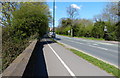
B4110 London Road
Crossing the River Sowe at Willenhall Bridge.
Image: © Mat Fascione
Taken: 18 Apr 2015
0.07 miles
8
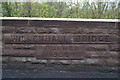
Inscription on the south parapet of Willenhall Bridge, Willenhall, southeast Coventry
The bridge carries the London Road over the River Sowe. The inscription reads:
"Willenhall Bridge
Widened
1930"
Image: © Robin Stott
Taken: 30 Apr 2016
0.07 miles
9
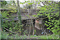
Willenhall Bridge and pipes cross the River Sowe, Willenhall, southeast Coventry
Willenhall Bridge, widened in 1930, carries the London Road over the river.
Image: © Robin Stott
Taken: 30 Apr 2016
0.07 miles
10
A glimpse of the former Chace Guildhouse from Chace Avenue, Willenhall, Coventry
Extensive hostel accommodation in Willenhall was first laid out in 1941 for war workers and refugees. The original site to the east of Chace Avenue (behind the camera) was redeveloped for housing in the late 1980s, I think. The hostel accommodation was replaced by the Chace Centre, latterly described as a supported living centre for homeless people. The Chase Guildhouse provided a range of facilities for residents. The replacement for the Chace Centre is the Gateway Centre of Excellence in Hillfields, Coventry, opened in 2015. The Chace site is to be redeveloped for over 75 mixed tenure homes.
The sky was clearing after an icy, late April shower.
Image: © Robin Stott
Taken: 30 Apr 2016
0.07 miles