
IMAGES TAKEN NEAR TO
Marchant Way, WARWICK, CV34 7BY
Introduction
This page details the photographs taken nearby to Marchant Way, CV34 7BY by members of the Geograph project.
The Geograph project started in 2005 with the aim of publishing, organising and preserving representative images for every square kilometre of Great Britain, Ireland and the Isle of Man.

There are currently over 7.5m images from over14,400 individuals and you can help contribute to the project by visiting https://www.geograph.org.uk
Image Map
Images are licensed for reuse under creativecommons.org/licenses/by-sa/2.0
Notes
- Clicking on the map will re-center to the selected point.
- The higher the marker number, the further away the image location is from the centre of the postcode.
Image Listing (8 Images Found)
Images are licensed for reuse under creativecommons.org/licenses/by-sa/2.0
Image
Details
Distance
1
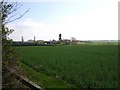
Lower Heathcote Farm
Looking SSE from near the Europa Way roundabout towards the farm.
Image: © David P Howard
Taken: 14 Apr 2010
0.12 miles
2
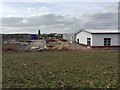
Primary school under construction to serve new estates, Heathcote, Leamington
Several developers are at work south of Harbury Lane. Together, their estates will form a whole new suburb, extending Leamington ever southwards.
Image: © Robin Stott
Taken: 10 Apr 2017
0.15 miles
3
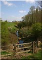
Tach Brook by the side of the A452 Europa Way
Looking SE from the edge of the road. I have seen this brook flood to the extent that the road I am standing by, is covered with water!
Image: © David P Howard
Taken: 14 Apr 2010
0.18 miles
4
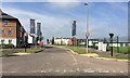
Garrett Drive, Heathcote
A Barratt Homes development in progress. On the right is part of the brand new Heathcote Primary School. The view is across Harbury Lane, now with a 40mph speed limit, reduced from 50mph. Whether that will make it less of a racetrack remains to be seen.
Image: © Robin Stott
Taken: 3 Jun 2018
0.21 miles
5
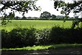
Site of proposed Gallagher Business Park, Heathcote
Despite having planning permission this prime site, seen from Heathcote Lane, remains undeveloped. It is a plateau of heavy soil - better as woodland?. Harbury Lane runs across the picture, centre.
Image: © Robin Stott
Taken: 22 Aug 2009
0.22 miles
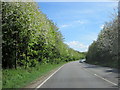
7
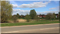
Open space around a surface water lagoon, Warwick Gates estate, Heathcote, Leamington
Warwick Gates was developed in the 1990s, stimulated by the completion of the M40 motorway in 1991. There is a surface water lagoon at each corner of the estate. They are designed to release water slowly to watercourses. The view is across Harbury Lane.
Image: © Robin Stott
Taken: 10 Apr 2017
0.24 miles
8
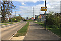
New housing developments south of Harbury Lane, Heathcote, Leamington
Ash Meadow and Poets Meadow are just two of the many small residential developments now planned south of Harbury Lane. A new primary school is going up on the site to the right. You would expect there to be a need for other local facilities also. Note the old hedgerow oaks lending some historical depth to a landscape that, apart from Harbury Lane itself, came into being in the 1990s.
Image: © Robin Stott
Taken: 10 Apr 2017
0.25 miles