Garrett Drive, Heathcote
Introduction
The photograph on this page of Garrett Drive, Heathcote by Robin Stott as part of the Geograph project.
The Geograph project started in 2005 with the aim of publishing, organising and preserving representative images for every square kilometre of Great Britain, Ireland and the Isle of Man.

There are currently over 7.5m images from over 14,400 individuals and you can help contribute to the project by visiting https://www.geograph.org.uk
Garrett Drive, Heathcote
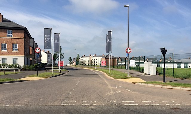
Image: © Robin Stott Taken: 3 Jun 2018
A Barratt Homes development in progress. On the right is part of the brand new Heathcote Primary School. The view is across Harbury Lane, now with a 40mph speed limit, reduced from 50mph. Whether that will make it less of a racetrack remains to be seen.
Images are licensed for reuse under creativecommons.org/licenses/by-sa/2.0
Image Location
Latitude
52.264665
Longitude
-1.550117