1
Aylesford School, Warwick
One of Warwick's two state secondary schools, seen across the channel of the Gog Brook from Shelley Avenue.
Image: © Robin Stott
Taken: 28 Aug 2009
0.05 miles
2
Shreres Dyche houses, Warwick
Viewed across Gog Brook. I don't know the origins of the street name Shreres Dyche.
Dyche could be an Old English form of ditch or dyke, but that's only a guess.
Image: © Jaggery
Taken: 3 Oct 2015
0.09 miles
3
Recently-built houses viewed from Shelley Avenue, Warwick
View in early October 2015 across Gog Brook. The houses are not yet shown in the maps I use,
all of which show a green field here on the south bank of Gog Brook in the grounds of Aylesford School.
Image: © Jaggery
Taken: 3 Oct 2015
0.09 miles
4
Gog Brook, Warwick
Viewed from this http://www.geograph.org.uk/photo/4689452 footbridge.
Image: © Jaggery
Taken: 3 Oct 2015
0.10 miles
5
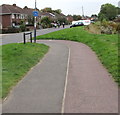
Path to Shelley Avenue, Warwick
The path from Mander Grove approaches Shelley Avenue.
Image: © Jaggery
Taken: 3 Oct 2015
0.10 miles
6
Aylesford School, southwest Warwick
Aylesford was a local authority-maintained, mixed-sex secondary school built on part of the land that made up RAF Warwick, which closed in 1946. The school first appears on an OS map of 1965 as Warwick Aylesford High School. On 1st January 2012 the school became an independent academy, now known as Aylesford School and Sixth Form College and maintained by grants from the Secretary of State for Education. The recent addition of a Primary School gives Aylesford the ability to be an 'All Through School'.
Although a wide-angle view this photo is from the same viewpoint as the first 'geograph' for the SP2763 gridsquare,
Image, taken by David Stowell in 2005. The school has clearly expanded. I was surprised to see that the Chase Meadow estate had already begun, on the left in the photos.
Image: © Robin Stott
Taken: 29 Sep 2020
0.12 miles
7
New Housing, Chase Meadow, Warwick
To the east of Chase Meadow Park, a newer section of an expansion development of the once relatively compact county town.
Image: © Stuart Shepherd
Taken: 1 Apr 2018
0.12 miles
8
Bridge over Gog Brook
This is a view south-west along Gog Brook towards the bridge between Chase meadow and the adjacent residential estate. The brook often has ducks and finches along its banks.
Image: © Jeremy Worrell
Taken: 17 Jun 2007
0.12 miles
9
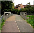
Gog Brook footbridge, Warwick
The bridge carries a footpath and cycleway over the brook. http://www.geograph.org.uk/photo/468954 to a side view.
Image: © Jaggery
Taken: 3 Oct 2015
0.12 miles
10
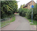
Cycle lane - look both ways, Warwick
The blue sign is at a path junction near Gog Brook. http://www.geograph.org.uk/photo/4689472
Image: © Jaggery
Taken: 3 Oct 2015
0.12 miles


