Aylesford School, southwest Warwick
Introduction
The photograph on this page of Aylesford School, southwest Warwick by Robin Stott as part of the Geograph project.
The Geograph project started in 2005 with the aim of publishing, organising and preserving representative images for every square kilometre of Great Britain, Ireland and the Isle of Man.

There are currently over 7.5m images from over 14,400 individuals and you can help contribute to the project by visiting https://www.geograph.org.uk
Aylesford School, southwest Warwick
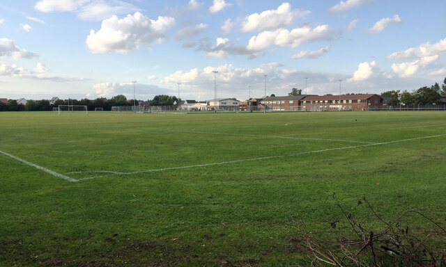
Image: © Robin Stott Taken: 29 Sep 2020
Aylesford was a local authority-maintained, mixed-sex secondary school built on part of the land that made up RAF Warwick, which closed in 1946. The school first appears on an OS map of 1965 as Warwick Aylesford High School. On 1st January 2012 the school became an independent academy, now known as Aylesford School and Sixth Form College and maintained by grants from the Secretary of State for Education. The recent addition of a Primary School gives Aylesford the ability to be an 'All Through School'. Although a wide-angle view this photo is from the same viewpoint as the first 'geograph' for the SP2763 gridsquare, Image, taken by David Stowell in 2005. The school has clearly expanded. I was surprised to see that the Chase Meadow estate had already begun, on the left in the photos.
Images are licensed for reuse under creativecommons.org/licenses/by-sa/2.0
Image Location
Latitude
52.269434
Longitude
-1.601506