
IMAGES TAKEN NEAR TO
Queens Square, WARWICK, CV34 6HP
Introduction
This page details the photographs taken nearby to Queens Square, CV34 6HP by members of the Geograph project.
The Geograph project started in 2005 with the aim of publishing, organising and preserving representative images for every square kilometre of Great Britain, Ireland and the Isle of Man.

There are currently over 7.5m images from over14,400 individuals and you can help contribute to the project by visiting https://www.geograph.org.uk
Image Map
Images are licensed for reuse under creativecommons.org/licenses/by-sa/2.0
Notes
- Clicking on the map will re-center to the selected point.
- The higher the marker number, the further away the image location is from the centre of the postcode.
Image Listing (436 Images Found)
Images are licensed for reuse under creativecommons.org/licenses/by-sa/2.0
Image
Details
Distance
1
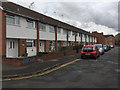
A terrace of houses in Queens Square, Warwick
An old map shows terraced houses here in 1887. The present houses appear on an OS map of 1967-70.
Image: © Robin Stott
Taken: 12 Oct 2016
0.02 miles
2
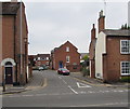
Charter Approach, Warwick
Looking across West Street along Charter Approach towards Tudor Place.
Image: © Jaggery
Taken: 3 Oct 2015
0.03 miles
3
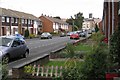
Woodhouse Street, Warwick
It runs parallel to Hampton Street. This view is towards flats in Monks Way, with the tower of St Mary's Church beyond Image
Image: © Robin Stott
Taken: 27 Aug 2009
0.03 miles
4
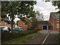
Footpath to Charter Approach from Queen's Square, Warwick
Queen's Square was there in the 19th century: two-storey terraced houses. Charter Approach is more recent: late 20th or early 21st-century. It is on the site of an engineering works in the backland of West Street, glimpsed left. The works first appeared on an OS map of 1952 (a wartime development?) and had extended through to the back of St Laurence Avenue on a map of 1966-72. In the 19th century and up to World War II the site was a tannery and skin works. A brook still runs through here on its way to the Avon.
Image: © Robin Stott
Taken: 12 Oct 2016
0.04 miles
5
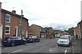
Southeast on Stand Street, southwest Warwick
Outside the Georgian town centre, an uncharacteristically wide street of 19th and 20th-century houses of different types. It takes its name from the racecourse stand (dating from 1809) that closes the view in the opposite direction: Image
Image: © Robin Stott
Taken: 12 Oct 2016
0.06 miles
7
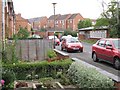
Queen's Square, Warwick
Looking towards a scout hut and new housing in Charter Approach, shoe-horned in behind West Street.
Image: © Robin Stott
Taken: 27 Aug 2009
0.06 miles
8
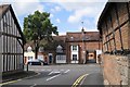
West Street, Warwick, from Stuart Close
Image: © Robin Stott
Taken: 27 Aug 2009
0.06 miles
9
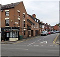
Crompton Street, Warwick
Viewed across West Street. Redmayne-Bentley independent stockbrokers office is on the corner.
Image: © Jaggery
Taken: 3 Oct 2015
0.07 miles
10
![Warwick houses [133]](https://s0.geograph.org.uk/geophotos/06/62/50/6625016_a544bb29_120x120.jpg)
Warwick houses [133]
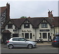
In West Street, numbers 78 and 80 (seen here), and numbers 82 and 84 Image are 18th century or possibly earlier. Listed, grade II, with details at: https://historicengland.org.uk/listing/the-list/list-entry/1035349
A market town and county town of Warwickshire, Warwick lies on the River Avon, 11 miles (18 kilometres) south of Coventry. There is evidence of unbroken habitation from the 6th century AD with signs of Neolithic and Roman activity before that date. It was a Saxon burh in the 9th century and Warwick Castle was built during the Norman Conquest. Much of the town was destroyed in The Great Fire of Warwick in 1694. Warwick Racecourse is located just west of the town centre. The Grand Union Canal passes through the town and the restored Saltisford Canal Arm is close to the town centre.
Image: © Michael Dibb
Taken: 5 Aug 2020
0.07 miles