
IMAGES TAKEN NEAR TO
Monks Way, WARWICK, CV34 6HH
Introduction
This page details the photographs taken nearby to Monks Way, CV34 6HH by members of the Geograph project.
The Geograph project started in 2005 with the aim of publishing, organising and preserving representative images for every square kilometre of Great Britain, Ireland and the Isle of Man.

There are currently over 7.5m images from over14,400 individuals and you can help contribute to the project by visiting https://www.geograph.org.uk
Image Map
Images are licensed for reuse under creativecommons.org/licenses/by-sa/2.0
Notes
- Clicking on the map will re-center to the selected point.
- The higher the marker number, the further away the image location is from the centre of the postcode.
Image Listing (678 Images Found)
Images are licensed for reuse under creativecommons.org/licenses/by-sa/2.0
Image
Details
Distance
1
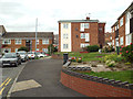
Flats and front gardens, Abbots Way, Warwick
Image: © Robin Stott
Taken: 20 Sep 2013
0.03 miles
3
![Warwick buildings [122]](https://s1.geograph.org.uk/geophotos/06/62/64/6626401_bc070eb0_120x120.jpg)
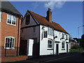
Warwick buildings [122]
This building at number 50 Friars Street was the Seven Stars beerhouse, more recently a bed and breakfast establishment. There is an 18th century front on an older (17th century?) timber framed structure. There is a history of the beerhouse at http://www.hunimex.com/warwick/pubs/ Listed, grade II, with details at: https://historicengland.org.uk/listing/the-list/list-entry/1035459
A market town and county town of Warwickshire, Warwick lies on the River Avon, 11 miles (18 kilometres) south of Coventry. There is evidence of unbroken habitation from the 6th century AD with signs of Neolithic and Roman activity before that date. It was a Saxon burh in the 9th century and Warwick Castle was built during the Norman Conquest. Much of the town was destroyed in The Great Fire of Warwick in 1694. Warwick Racecourse is located just west of the town centre. The Grand Union Canal passes through the town and the restored Saltisford Canal Arm is close to the town centre.
Image: © Michael Dibb
Taken: 5 Aug 2020
0.03 miles
4
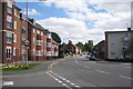
Friars Street, Warwick
A view towards the town from the junction with Bread and Meat Close. The housing development on council-owned land, left, helped pay for a reorganisation of racecourse facilities and improvements to the Common, all behind and to the left of the camera. Beyond the flats is the churchyard of St Paul's Church. The tower is that of the church at Westgate. On the right is Crompton Street.
Image: © Robin Stott
Taken: 27 Aug 2009
0.04 miles
5
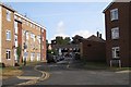
Monks Way, Warwick
Seen from Crompton Street.
Image: © Robin Stott
Taken: 4 Oct 2009
0.04 miles
6
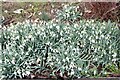
View of snowdrops in the grounds of St. Paul's Church from Hampton Street
Looking northwest.
Image: © Robert Lamb
Taken: 25 Feb 2023
0.04 miles
7
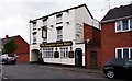
The Old Fourpenny Shop Hotel (1), 27-29 Crompton Street, Warwick
A small hotel with bar open to non-residents, and with a selection of real ales. Probably about two hundred years old.
Image
Image: © P L Chadwick
Taken: 27 Jul 2015
0.04 miles
8
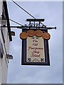
The Old Fourpenny Shop Hotel (2) - sign, 27-29 Crompton Street, Warwick
The name apparently originates from the time the Warwick section of the Grand Union Canal was being constructed in the early 1800's. The Fourpenny Inn was charging four pennies for a cup of coffee and a tot of rum, but rivals were charging six pennies. The price difference made the inn very popular although in those days even four pennies was quite a lot of money. Where the shop part of the current name came from isn't clear. Both sides of the sign have four large replicas of Victorian pennies, though probably construction of the canal in Warwick took place before Victoria became Queen.
Image
Image: © P L Chadwick
Taken: 27 Jul 2015
0.04 miles
9
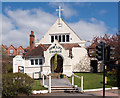
New Life Church, Warwick - April 2019
The building dates from 1893 and may be a Baptist congregation, but there is little information on the web site which may be found: https://www.ctwarwick.org.uk/new-life-church.html
I have no connection with this Church and all queries should be directed through the web site.
Image: © The Carlisle Kid
Taken: 10 Apr 2019
0.04 miles
10
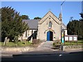
Warwick - St Pauls Church
Close to racecourse on the road to Henley-in Arden.
Image: © Ian Rob
Taken: 5 Mar 2006
0.05 miles