
IMAGES TAKEN NEAR TO
Capulet Drive, WARWICK, CV34 6EW
Introduction
This page details the photographs taken nearby to Capulet Drive, CV34 6EW by members of the Geograph project.
The Geograph project started in 2005 with the aim of publishing, organising and preserving representative images for every square kilometre of Great Britain, Ireland and the Isle of Man.

There are currently over 7.5m images from over14,400 individuals and you can help contribute to the project by visiting https://www.geograph.org.uk
Image Map
Images are licensed for reuse under creativecommons.org/licenses/by-sa/2.0
Notes
- Clicking on the map will re-center to the selected point.
- The higher the marker number, the further away the image location is from the centre of the postcode.
Image Listing (21 Images Found)
Images are licensed for reuse under creativecommons.org/licenses/by-sa/2.0
Image
Details
Distance
1
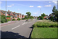
Earl Rivers Avenue, Warwick Gates estate
The traffic calming island doesn't slow anyone down and nature is taking over the stereotyped landscaping.
Image: © Robin Stott
Taken: 11 Aug 2009
0.06 miles
2
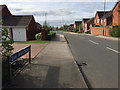
West on Earl Rivers Avenue, Warwick Gates estate, Heathcote, south Leamington
Warwick Gates is a large estate established in the late 1990s and now around 20 years old. It was a development stimulated by the full completion of the M40 motorway in 1991. All the roads are named after characters from Shakespeare's plays.
Image: © Robin Stott
Taken: 10 Apr 2017
0.07 miles
3

Welcome to Poets Meadow, Heathcote, south Leamington
Poets Meadow (no apostrophe) is one of several small new residential developments along the south side of Harbury Lane. Four or five different developers are getting a bite of the cherry.
Image: © Robin Stott
Taken: 3 Jun 2018
0.09 miles
4
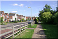
Tamora Close, Warwick Gates estate
One of several closes on the southern side of Warwick Gates facing busy Harbury Lane, but screened from it by an existing hedgerow beefed up with trees and shrubs. The footpath runs the whole length, some 1200 metres.
Image: © Robin Stott
Taken: 11 Aug 2009
0.09 miles
5
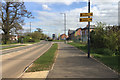
New housing developments south of Harbury Lane, Heathcote, Leamington
Ash Meadow and Poets Meadow are just two of the many small residential developments now planned south of Harbury Lane. A new primary school is going up on the site to the right. You would expect there to be a need for other local facilities also. Note the old hedgerow oaks lending some historical depth to a landscape that, apart from Harbury Lane itself, came into being in the 1990s.
Image: © Robin Stott
Taken: 10 Apr 2017
0.09 miles
6
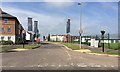
Garrett Drive, Heathcote
A Barratt Homes development in progress. On the right is part of the brand new Heathcote Primary School. The view is across Harbury Lane, now with a 40mph speed limit, reduced from 50mph. Whether that will make it less of a racetrack remains to be seen.
Image: © Robin Stott
Taken: 3 Jun 2018
0.13 miles
7
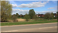
Open space around a surface water lagoon, Warwick Gates estate, Heathcote, Leamington
Warwick Gates was developed in the 1990s, stimulated by the completion of the M40 motorway in 1991. There is a surface water lagoon at each corner of the estate. They are designed to release water slowly to watercourses. The view is across Harbury Lane.
Image: © Robin Stott
Taken: 10 Apr 2017
0.13 miles
8
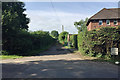
Drive to a former sewage treatment site, Heathcote, south Leamington
Nigel Mykura went a bit further Image and Colin Craig went further still in 2009: Image and Image A full-blown sewage works for Leamington Corporation is first shown here on an OS map of 1939; the house not till 1968. The site is on a low summit, allowing effluent to drain into the Tach Brook, thence to the River Avon above the village of Barford. It became redundant in the 1970s after the opening of the sewage works at Longbridge southwest of Warwick, built to serve both towns (and now operated by Severn Trent Water).
It's not clear how the sewage reached the works. From 1871 Leamington Board of Health had by necessity pumped sewage from the works at Edmondscote Image by a rising main to the Earl of Warwick's land at Heathcote, a rise of 20m over a distance of about 3km, where it was reportedly treated and sold to farmers. Treatment may have consisted of being spread on the land to be naturally irrigated by rain. Old maps show no feature that can be interpreted as a pipeline, yet there were reports of bursts. If it was underground, where did it come to the surface? Did it supply the 1939 works? Alternatively from 1871, could it have been only a short length to an area where solids could be loaded on to carts and conveyed to Heathcote?
Refs: Lyndon F. Cave. Royal Leamington Spa, a history; Phillimore, 2009 ISBN 978-1-86077-505-5
Contemporary newspapers, town council minutes, www.old-maps.co.uk
Image: © Robin Stott
Taken: 3 Jun 2018
0.13 miles
9
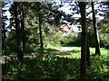
Pine wood, Warwick Gates estate
A small plantation of stunted Scots Pine was one of the few features of the farmland site that was developed as Warwick Gates. It forms part of a sequence of open spaces.
Image: © Robin Stott
Taken: 11 Aug 2009
0.14 miles
10
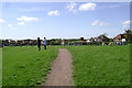
Western open space, Warwick Gates estate
With a toddlers' playarea, right. This view is from near Ophelia Drive, looking towards houses in Cordelia Green, left, just out of the square.
Image: © Robin Stott
Taken: 11 Aug 2009
0.14 miles