
IMAGES TAKEN NEAR TO
Costard Avenue, WARWICK, CV34 6BP
Introduction
This page details the photographs taken nearby to Costard Avenue, CV34 6BP by members of the Geograph project.
The Geograph project started in 2005 with the aim of publishing, organising and preserving representative images for every square kilometre of Great Britain, Ireland and the Isle of Man.

There are currently over 7.5m images from over14,400 individuals and you can help contribute to the project by visiting https://www.geograph.org.uk
Image Map
Images are licensed for reuse under creativecommons.org/licenses/by-sa/2.0
Notes
- Clicking on the map will re-center to the selected point.
- The higher the marker number, the further away the image location is from the centre of the postcode.
Image Listing (51 Images Found)
Images are licensed for reuse under creativecommons.org/licenses/by-sa/2.0
Image
Details
Distance
1
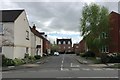
Pericles Close, Warwick Gates estate, Royal Leamington Spa
Image: © Robin Stott
Taken: 10 Apr 2017
0.02 miles
2
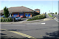
Cressida Close shopping centre, Warwick Gates estate
The view from Othello Avenue, right, is: Image The shops and the undersized car park always seem to be busy. They are the only shops on an estate of perhaps 80 hectares.
Image: © Robin Stott
Taken: 11 Aug 2009
0.05 miles
3
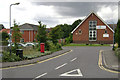
Cressida Close, Warwick Gates
Every street on this large estate is named after a character from Shakespeare's plays, sometimes with incongruous results. Ahead is the Warwick Gates Community Church, with Heathcote Rehabilitation Hospital behind it. There is a health centre to the left of this view, and a small shopping centre to the right Image The postbox ID is CV34 144.
Image: © Robin Stott
Taken: 30 Jul 2009
0.05 miles
4
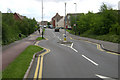
Othello Avenue, Warwick Gates estate
One of the main ways into this extensive new estate, whose every street is named after a character from Shakespeare's plays.
Image: © Robin Stott
Taken: 30 Jul 2009
0.05 miles
5
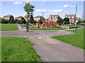
Central open space, Warwick Gates estate
The OS Landranger map doesn't show any of the Warwick Gates estate yet. The overhead power line was undergrounded after lengthy negotiations between the developer, the electricity company and the planners, under pressure from local people for burying the cable. It runs beneath open space, verges and undeveloped land. Here it's beneath the cycle path. At its northwest end it goes underground by Europa Way Image
Image: © Robin Stott
Taken: 11 Aug 2009
0.09 miles
6
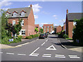
Coriolanus Square, Warwick Gates estate
Warwick Gates is one of two large residential developments to have been built to the south of Leamington and Warwick. Almost all the streets are named after characters in Shakespeare's plays. The Bard must be rotating in his sepulchrum.
Image: © Robin Stott
Taken: 11 Aug 2009
0.09 miles
7
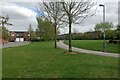
Open space by Ophelia Drive, Warwick Gates estate, Heathcote, south Leamington
Image: © Robin Stott
Taken: 10 Apr 2017
0.10 miles
8
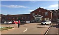
Royal Leamington Spa Rehabilitation Hospital, Heathcote Lane
The hospital has greatly increased in size over the years. It is part of the South Warwickshire NHS Foundation Trust (SWIFT). It is home to the Central England Rehabilitation Unit (CERU).
Image: © Robin Stott
Taken: 18 Sep 2019
0.10 miles
9
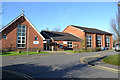
Warwick Gates Community Church and church hall, Cressida Close, Leamington
This is part of a local centre for the Warwick Gates estate and passing trade on Heathcote Lane. There's a doctor's surgery to the left and local shops, including a Co-op convenience store, to the right.
Image: © Robin Stott
Taken: 29 Dec 2015
0.11 miles
10
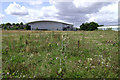
HSBC Exchange building, Trident Park, south Leamington
Occupied by Merrill Lynch until recently, following its beginnings as a call centre. Seen from the vacant plot 4200. The south side of AP/Raical Clutches appears on the right. The OS Landranger map for SP3163 is seriously out of date.
Image: © Robin Stott
Taken: 30 Jul 2009
0.11 miles