
IMAGES TAKEN NEAR TO
Harmar Close, WARWICK, CV34 5UT
Introduction
This page details the photographs taken nearby to Harmar Close, CV34 5UT by members of the Geograph project.
The Geograph project started in 2005 with the aim of publishing, organising and preserving representative images for every square kilometre of Great Britain, Ireland and the Isle of Man.

There are currently over 7.5m images from over14,400 individuals and you can help contribute to the project by visiting https://www.geograph.org.uk
Image Map
Images are licensed for reuse under creativecommons.org/licenses/by-sa/2.0
Notes
- Clicking on the map will re-center to the selected point.
- The higher the marker number, the further away the image location is from the centre of the postcode.
Image Listing (86 Images Found)
Images are licensed for reuse under creativecommons.org/licenses/by-sa/2.0
Image
Details
Distance
1
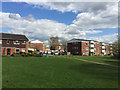
Houses and flats off Twycross Walk, Woodloes Park, north Warwick
Through the gap is Warner Close.
Image: © Robin Stott
Taken: 17 Apr 2016
0.07 miles
2
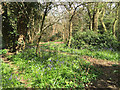
Bluebells in a patch of woodland by Twycross Walk, Woodloes Park, Warwick
The wood is a maze of informal paths – too many. There is a scout hut at the north end. Some flats can be made out through the trees.
Image: © Robin Stott
Taken: 17 Apr 2016
0.09 miles
3
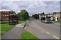
West end of Deansway, Woodloes Park
The main artery of the south-western part of the estate
Image: © Robin Stott
Taken: 17 Aug 2009
0.10 miles
4
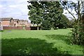
Greenspace to the rear of Corbison Close, Woodloes Park
Looking towards the rear of Lowes Avenue.
Image: © Robin Stott
Taken: 17 Aug 2009
0.10 miles
5
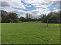
Public open space by Twycross Walk, Woodloes Park, north Warwick
Twycross Walk houses and flats are offstage left. Ahead and offstage right is the Wedgnock industrial estate. Warwick Scouts still have their hut in the little wood, left. Although blank white on the map, clumps of vegetation create pleasant spaces, frame inviting views.
Image: © Robin Stott
Taken: 17 Apr 2016
0.13 miles
6
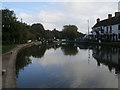
Grand Union Canal
Grand Union Canal at The Cape of Good Hope pub
Image: © Shaun Ferguson
Taken: 11 Oct 2016
0.15 miles
7

Jogging at Cape Bottom Lock, Grand Union Canal, north Warwick
On a bright 2nd of January.
Image: © Robin Stott
Taken: 2 Jan 2017
0.15 miles
8
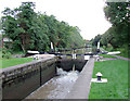
Lock No 24, Grand Union Canal near Warwick
This is the lower of the two Cape Locks which lift the water level by 14ft 4in (about 4.4 metres). The leakage seems to have been improved a bit by August 2009: Image]
Image: © Roger D Kidd
Taken: 4 Sep 2008
0.15 miles
9
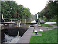
Lock No 24, Grand Union Canal near Warwick
This is the lower of the two Cape Locks which lift the water level by 14ft 4in (about 4.4 metres). The leakage seems to have been improved a bit by August 2009: Image]
Image: © Roger D Kidd
Taken: 4 Sep 2008
0.15 miles
10
![Warwick canal [5]](https://s3.geograph.org.uk/geophotos/06/62/92/6629279_5517cec9_120x120.jpg)
Warwick canal [5]
Seen from the towpath is the top of Warwick Bottom Lock. The footbridge beyond connects Lock Lane with the Woodloes Park housing estate. The towpath is part of two long distance footpaths - The Grand Union Canal Walk and Shakespeare's Avon Way.
A market town and county town of Warwickshire, Warwick lies on the River Avon, 11 miles (18 kilometres) south of Coventry. There is evidence of unbroken habitation from the 6th century AD with signs of Neolithic and Roman activity before that date. It was a Saxon burh in the 9th century and Warwick Castle was built during the Norman Conquest. Much of the town was destroyed in The Great Fire of Warwick in 1694. Warwick Racecourse is located just west of the town centre. The Grand Union Canal passes through the town and the restored Saltisford Canal Arm is close to the town centre.
Image: © Michael Dibb
Taken: 4 Aug 2020
0.15 miles