1
West end of Chesford Crescent, Spinney Hill estate, Warwick
Some areas lack street nameplates but the local authorities here are very good at providing them. Styles differ from place to place and change over time. This example looks like cast aluminium or iron, the lettering is one of the Goudy family of typefaces, in white on a blue background.
Image: © Robin Stott
Taken: 19 Mar 2013
0.01 miles
2
Lamb Close, Spinney Hill estate, Warwick
A recent housing development shoehorned in at the back of Greville Road, to which the rear access is seen going off to the left. In the background, right, is the rear of Chesford Crescent.
Image: © Robin Stott
Taken: 19 Mar 2013
0.04 miles
3
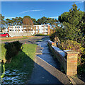
Chesford Crescent, Warwick
A rare piece of greenspace in a drab council housing estate.
Image: © Robin Stott
Taken: 31 Mar 2009
0.04 miles
4
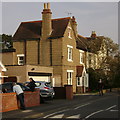
All Saints Road
An unusual 3-storey semi built of exposed aggregate concrete blocks (enhanced by a fine Magnolia).
There are 2-storey versions round the corner at
Image See also
Image
Image: © Robin Stott
Taken: 20 Mar 2009
0.06 miles
5
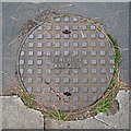
Cast iron inspection cover, All Saints Road, Warwick
From the foundry of T C Neville, Walsall. The pine needles are from these trees http://www.geograph.org.uk/photo/1228274
Image: © Robin Stott
Taken: 23 Sep 2013
0.06 miles
6
North end of All Saints Road, Warwick
The pine trees are a legacy of the Nelson family, whose employees had houses in the area.
Image: © Robin Stott
Taken: 25 Sep 2020
0.07 miles
7
Top of George Road, Warwick, with corner sofa
Unusual for the area, it's fair to say. One hopes it has been left at the roadside for collection by a charity or the council. More seriously, the belts of pine trees in this part of Warwick merit further research.
Image: © Robin Stott
Taken: 14 Jul 2015
0.07 miles
8
Houses and flats under construction, Hobson?s Choice site, All Saints Road, Warwick
Note the solar panels on the roofs.
A year ago in March 2013 the site looked like this:
Image
Image: © Robin Stott
Taken: 11 Mar 2014
0.07 miles
9
Frost melting, George Road, Warwick
As the sun has moved round it has melted the moderate frost of the previous night. Photographed soon after midday.
Image: © Robin Stott
Taken: 10 Dec 2022
0.07 miles
10
Northwest end of All Saints Road
Rohan Court flats under construction, centre
Image: © Robin Stott
Taken: 27 Dec 2012
0.07 miles


