
IMAGES TAKEN NEAR TO
Lyttelton Road, WARWICK, CV34 5EL
Introduction
This page details the photographs taken nearby to Lyttelton Road, CV34 5EL by members of the Geograph project.
The Geograph project started in 2005 with the aim of publishing, organising and preserving representative images for every square kilometre of Great Britain, Ireland and the Isle of Man.

There are currently over 7.5m images from over14,400 individuals and you can help contribute to the project by visiting https://www.geograph.org.uk
Image Map
Images are licensed for reuse under creativecommons.org/licenses/by-sa/2.0
Notes
- Clicking on the map will re-center to the selected point.
- The higher the marker number, the further away the image location is from the centre of the postcode.
Image Listing (141 Images Found)
Images are licensed for reuse under creativecommons.org/licenses/by-sa/2.0
Image
Details
Distance
1
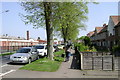
Millers Road, Warwick - zone boundary
Like Montague Road in the adjoining Image council housing faces manufacturing, retail and services across a major artery.
Plenty of work for window cleaners, you would think.
Image: © Robin Stott
Taken: 20 Apr 2009
0.02 miles
2
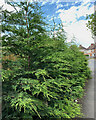
Trouble in store, Peel Road, Warwick
Leyland Cypress has been planted in a narrow strip of ground seemingly to hide a fence. Leyland is the market leader of fast-growing conifers. Given time it'll block the road.
Image: © Robin Stott
Taken: 3 Jun 2022
0.03 miles
3
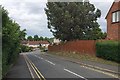
Sudden descent ? Peel Road, Packmores estate, Warwick
Image: © Robin Stott
Taken: 8 Jun 2019
0.04 miles
4
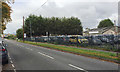
West on Millers Road, Warwick
Out-of-shot left: houses with no garages, parked cars. On the right, between the north side of the road and the canal, manufacturing and service businesses, particularly vehicle servicing. A screen of Leyland Cypress draws attention to itself.
Image: © Robin Stott
Taken: 28 Sep 2017
0.04 miles
5
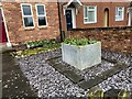
A tank of tulips, Warwick
This smallest of gardens has the simplest formal layout around its centrepiece, an old water tank here proving its excellence for a seasonal display of flowers. Late March: tulips.
Photo number 7855919.
Image: © Robin Stott
Taken: 25 Mar 2024
0.04 miles
6

Uphill and west on Millers Road, Warwick
Ahead is Warwick Hospital's drive-in swabbing service Image On the right is the entry to a staff car park.
Image: © Robin Stott
Taken: 3 Jun 2022
0.05 miles
7

Drive-in swabbing service, Millers Road, Warwick
Notices identify the building as 'Patient and staff Covid-19 swabbing service'. It is for, or primarily for, Warwick Hospital back down the road. It appeared in 2020, during the pandemic, and was still operating here in January 2022.
Image: © Robin Stott
Taken: 9 Jan 2022
0.05 miles
8
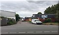
Ladbroke Park industrial estate, Millers Road, Warwick
The estate, one of several on the north side of Millers Road, extends up to the canal. On the right, a screen of Leyland Cypress reaches for the sky, seen from the east in Image
Image: © Robin Stott
Taken: 8 Jun 2019
0.06 miles
9
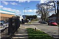
East on Millers Road, north Warwick
All kinds of businesses on the north side of the road; older council housing to the south: the Packmores estate.
Image: © Robin Stott
Taken: 25 Mar 2019
0.06 miles
10
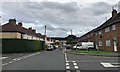
South on Lyttleton Road, Packmores, Warwick
From the junction with Peel Road.
Image: © Robin Stott
Taken: 8 Sep 2018
0.06 miles