
IMAGES TAKEN NEAR TO
Hanworth Road, WARWICK, CV34 5DX
Introduction
This page details the photographs taken nearby to Hanworth Road, CV34 5DX by members of the Geograph project.
The Geograph project started in 2005 with the aim of publishing, organising and preserving representative images for every square kilometre of Great Britain, Ireland and the Isle of Man.

There are currently over 7.5m images from over14,400 individuals and you can help contribute to the project by visiting https://www.geograph.org.uk
Image Map
Images are licensed for reuse under creativecommons.org/licenses/by-sa/2.0
Notes
- Clicking on the map will re-center to the selected point.
- The higher the marker number, the further away the image location is from the centre of the postcode.
Image Listing (107 Images Found)
Images are licensed for reuse under creativecommons.org/licenses/by-sa/2.0
Image
Details
Distance
1
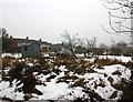
Allotments in the snow
Allotments by the Grand Union Canal off Cape Road, Warwick in the depths of winter.
Image: © David P Howard
Taken: 15 Jan 2010
0.03 miles
2
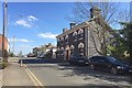
181 Cape Road, Warwick
The owner of this blue brick house believes that it was the coach house for Warwick Prison though outside the prison walls. After the prison was demolished in 1934 the house became a dairy, hence its current name: The Old Blue Dairy https://www.ourwarwickshire.org.uk/content/article/cape-road-former-prison-building Neither it nor the former Governor's House, the tall blue brick building centre-left, is listed Image
Image: © Robin Stott
Taken: 10 Apr 2019
0.06 miles
3
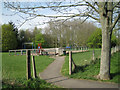
Play area near Antelope Gardens
Among the trees, Wedgnock Lane and the canal.
Image: © Robin Stott
Taken: 9 Apr 2011
0.07 miles
4
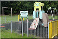
Saltisford Common Play Area
Children's play equipment is provided in this small enclosure on Saltisford Common, an open space between Cape Road and Birmingham Road in the Warwick suburbs.
Image: © Stephen McKay
Taken: 11 Aug 2021
0.07 miles
5
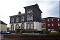
Governor's House
The governor's house of the former Warwick prison, now demolished and built over. This magnificently forbidding building was retained but unfortunately appears to have been severely modernised (plastic windows etc). How much period detail is left internally in what is now an office conversion is open to question.
Image: © Colin Craig
Taken: 5 Apr 2009
0.07 miles
6
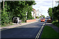
Cape Road canal bridge, Warwick
Cape Road is busy, fast, and takes quite a few heavy goods vehicles. The bridge is both skewed and restricted in width so, for some drivers, it can be a nerve-wracking spot.
Image: © Robin Stott
Taken: 13 Aug 2009
0.08 miles
7
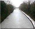
Bridge 50A from bridge 50, Grand Union Canal, Warwick
View SW along the frozen canal towards the Wedgenock Park bridge 50A.
Image: © David P Howard
Taken: 15 Jan 2010
0.08 miles
8
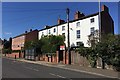
Nineteenth-century terrace, Upper Cape, Warwick
Unnamed on maps, this group stands out by being white and three storeys among mainly two-storey brick neighbours. Downpipes and chimneys confuse the eye but there are three properties here, each of two bays.
Image: © Robin Stott
Taken: 10 Apr 2019
0.08 miles
9
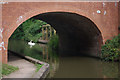
Wedgenock Park Bridge, Grand Union Canal
Two swans can be seen through this bridge in The Cape district of Warwick.
Image: © Stephen McKay
Taken: 8 Aug 2010
0.09 miles
10
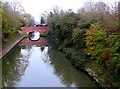
Grand Union Canal
View east along the canal with the bus crossing the Cape Road bridge. Viewed from the Wedgnock Lane Bridge.
Image: © Nigel Mykura
Taken: 20 Nov 2011
0.09 miles