Nineteenth-century terrace, Upper Cape, Warwick
Introduction
The photograph on this page of Nineteenth-century terrace, Upper Cape, Warwick by Robin Stott as part of the Geograph project.
The Geograph project started in 2005 with the aim of publishing, organising and preserving representative images for every square kilometre of Great Britain, Ireland and the Isle of Man.

There are currently over 7.5m images from over 14,400 individuals and you can help contribute to the project by visiting https://www.geograph.org.uk
Nineteenth-century terrace, Upper Cape, Warwick
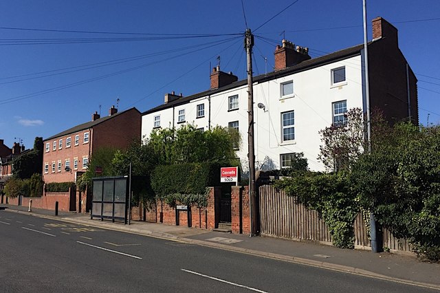
Image: © Robin Stott Taken: 10 Apr 2019
Unnamed on maps, this group stands out by being white and three storeys among mainly two-storey brick neighbours. Downpipes and chimneys confuse the eye but there are three properties here, each of two bays.
Images are licensed for reuse under creativecommons.org/licenses/by-sa/2.0
Image Location
Latitude
52.290634
Longitude
-1.596331