
IMAGES TAKEN NEAR TO
Roe Close, WARWICK, CV34 5AZ
Introduction
This page details the photographs taken nearby to Roe Close, CV34 5AZ by members of the Geograph project.
The Geograph project started in 2005 with the aim of publishing, organising and preserving representative images for every square kilometre of Great Britain, Ireland and the Isle of Man.

There are currently over 7.5m images from over14,400 individuals and you can help contribute to the project by visiting https://www.geograph.org.uk
Image Map
Images are licensed for reuse under creativecommons.org/licenses/by-sa/2.0
Notes
- Clicking on the map will re-center to the selected point.
- The higher the marker number, the further away the image location is from the centre of the postcode.
Image Listing (329 Images Found)
Images are licensed for reuse under creativecommons.org/licenses/by-sa/2.0
Image
Details
Distance
1
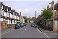
Paradise Street, Warwick
Looking from Woodville Road towards Lakin Road.
Image: © Robin Stott
Taken: 14 Apr 2009
0.02 miles
2
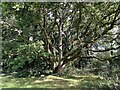
Coppiced oak, Priory Park, Warwick
An expert might hazard a guess at when the original tree might have been cut down; Priory Park has been parkland for centuries. The tree has recovered well, one might say: it is awesome, a magnificent presence, a world within a world.
Photo number 7647615.
Image: © Robin Stott
Taken: 9 Oct 2023
0.02 miles
3
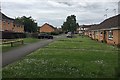
Sharpe Close, Packmores, Warwick
These houses and OAP bungalows first appear on an OS map of 1982-1985. From about 1905 the land had been allotments. Before that it looks like open space, part of Priory Ponds, that area of The Priory's grounds that was severed around 1850 by Brunel's Oxford-Birmingham extension of the Great Western Railway.
Image: © Robin Stott
Taken: 8 Jun 2019
0.02 miles
4
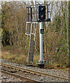
Warwick railway station photo survey (6)
The starter signal at the down (west) end of the up (eastbound) platform at Warwick railway station. This signal faces against the normal direction of travel because the lines through Warwick are signalled for bi-directional running (see also below).
Warwick station was opened in 1852 by the Great Western railway (GWR) as part of its route from Oxford to Birmingham. It is located approximately half-a-mile from the town centre and appears rather modest for such an historic town.
Today, Warwick station is managed by Chiltern Railways who also operate the majority of the train services although the station is also served by London Midland and CrossCountry.
The main station building and entrance is at the end of Station Road (a driveway from Coventry Road) on the south side of the line. There is also a smaller entrance from Woodcote Road on the north side of the line.
The red brick station building has changed little since its construction and it houses a waiting room, ticket office, staff rooms and a taxi business.
Warwick station's two facing platforms are connected by an underpass. The platforms are staggered slightly and are signalled for bi-directional running. The up platform (for London-bound services) is numbered 2 and the down platform (for Birmingham-bound services) is numbered 1. There is an indoor waiting room in the main building on platform 1 and also small waiting shelters on both platforms.
The station once had extensive goods sidings, a goods shed, a six-ton crane and a coal depot. Goods facilities declined rapidly during the 1950s and 60s and Warwick's goods yard closed in 1969.
Image: © Andy F
Taken: 14 Nov 2009
0.03 miles
5
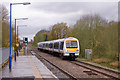
Warwick railway station photo survey (18)
An up train on a Birmingham Snow Hill to London Marylebone service arriving at Warwick railway station. This is operated by Chiltern Railways and is Class 168 diesel unit number 168217.
Warwick station was opened in 1852 by the Great Western railway (GWR) as part of its route from Oxford to Birmingham. It is located approximately half-a-mile from the town centre and appears rather modest for such an historic town.
Today, Warwick station is managed by Chiltern Railways who also operate the majority of the train services although the station is also served by London Midland and CrossCountry.
The main station building and entrance is at the end of Station Road (a driveway from Coventry Road) on the south side of the line. There is also a smaller entrance from Woodcote Road on the north side of the line.
The red brick station building has changed little since its construction and it houses a waiting room, ticket office, staff rooms and a taxi business.
Warwick station's two facing platforms are connected by an underpass. The platforms are staggered slightly and are signalled for bi-directional running. The up platform (for London-bound services) is numbered 2 and the down platform (for Birmingham-bound services) is numbered 1. There is an indoor waiting room in the main building on platform 1 and also small waiting shelters on both platforms.
The station once had extensive goods sidings, a goods shed, a six-ton crane and a coal depot. Goods facilities declined rapidly during the 1950s and 60s and Warwick's goods yard closed in 1969.
Image: © Andy F
Taken: 14 Nov 2009
0.03 miles
6
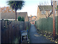
Footpath to Packmore Street, Warwick
Behind the camera is the broad path that runs on the north side of the railway, west from the station towards Priory Pools.
Image: © Robin Stott
Taken: 30 Nov 2019
0.03 miles
7
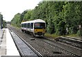
Leamington train in the rain
A southbound train arriving at Warwick. The torrential rain which had fallen for much of the afternoon (see Image] and others) was just easing off.
Image: © John Sutton
Taken: 29 Aug 2012
0.04 miles
8
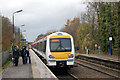
Warwick railway station photo survey (17)
A train on a London Marylebone to Birmingham Snow Hill service departing from Warwick railway station. The eight-car train is operated by Chiltern Railways and consists of two Class 168 diesel units (number 168216 nearest camera and unit 168112 leading).
Warwick station was opened in 1852 by the Great Western railway (GWR) as part of its route from Oxford to Birmingham. It is located approximately half-a-mile from the town centre and appears rather modest for such an historic town.
Today, Warwick station is managed by Chiltern Railways who also operate the majority of the train services although the station is also served by London Midland and CrossCountry.
The main station building and entrance is at the end of Station Road (a driveway from Coventry Road) on the south side of the line. There is also a smaller entrance from Woodcote Road on the north side of the line.
The red brick station building has changed little since its construction and it houses a waiting room, ticket office, staff rooms and a taxi business.
Warwick station's two facing platforms are connected by an underpass. The platforms are staggered slightly and are signalled for bi-directional running. The up platform (for London-bound services) is numbered 2 and the down platform (for Birmingham-bound services) is numbered 1. There is an indoor waiting room in the main building on platform 1 and also small waiting shelters on both platforms.
The station once had extensive goods sidings, a goods shed, a six-ton crane and a coal depot. Goods facilities declined rapidly during the 1950s and 60s and Warwick's goods yard closed in 1969.
Image: © Andy F
Taken: 14 Nov 2009
0.04 miles
9
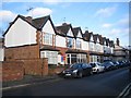
Terraced houses, Paradise Street, Warwick
Image: © Robin Stott
Taken: 26 Dec 2013
0.04 miles
10
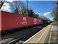
Container freight passes Warwick station
This line takes container freight in each direction every few hours, day and night. Imports, exports!
Image: © Robin Stott
Taken: 17 Mar 2022
0.04 miles