
IMAGES TAKEN NEAR TO
Chandley Wharf, WARWICK, CV34 5AT
Introduction
This page details the photographs taken nearby to Chandley Wharf, CV34 5AT by members of the Geograph project.
The Geograph project started in 2005 with the aim of publishing, organising and preserving representative images for every square kilometre of Great Britain, Ireland and the Isle of Man.

There are currently over 7.5m images from over14,400 individuals and you can help contribute to the project by visiting https://www.geograph.org.uk
Image Map
Images are licensed for reuse under creativecommons.org/licenses/by-sa/2.0
Notes
- Clicking on the map will re-center to the selected point.
- The higher the marker number, the further away the image location is from the centre of the postcode.
Image Listing (117 Images Found)
Images are licensed for reuse under creativecommons.org/licenses/by-sa/2.0
Image
Details
Distance
1
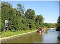
Grand Union Canal: The Cape Visitor Moorings
These are upstream of The Cape Top Lock, which is just visible in the distance.
Image: © Nigel Cox
Taken: 5 Sep 2012
0.01 miles
2
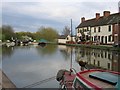
Cape of Good Hope, Warwick
The Cape of Good Hope Locks and Pub at Warwick, beside the Grand Union Canal. A good place to stop for refreshments after working down the Hatton Flight Image (or build up energy before working up them!).
Image: © David Stowell
Taken: 13 Apr 2005
0.03 miles
3
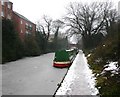
The Cape moorings, Grand Union Canal, Warwick
View SW towards bridge 50 past the frozen in narrowboats.
Image: © David P Howard
Taken: 15 Jan 2010
0.04 miles
4
![Warwick canal [3]](https://s3.geograph.org.uk/geophotos/06/62/92/6629275_86c6ccbc_120x120.jpg)
Warwick canal [3]
The Grand Union Canal approaches Warwick Top Lock. On the opposite bank of the canal is The Cape Of Good Hope, a popular public house which has given its name to an area of the town.
A market town and county town of Warwickshire, Warwick lies on the River Avon, 11 miles (18 kilometres) south of Coventry. There is evidence of unbroken habitation from the 6th century AD with signs of Neolithic and Roman activity before that date. It was a Saxon burh in the 9th century and Warwick Castle was built during the Norman Conquest. Much of the town was destroyed in The Great Fire of Warwick in 1694. Warwick Racecourse is located just west of the town centre. The Grand Union Canal passes through the town and the restored Saltisford Canal Arm is close to the town centre.
Image: © Michael Dibb
Taken: 4 Aug 2020
0.04 miles

6
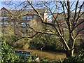
Grand Union Canal at the Cape, Warwick
Where once there was industry https://collection.sciencemuseumgroup.org.uk/people/cp16743/cape-engineering-company-limited four-storey blocks of flats overlook the canal. The photo is taken from the track down to Cape Top Lock from Cape Road. A photograph from 1972 by Dr Neil Clifton gives an impression of the change: Image
Image: © Robin Stott
Taken: 10 Apr 2019
0.05 miles
7
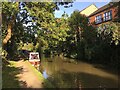
Leafy canalside, the Cape, Warwick
There are a number of moorings here, above Cape Top Lock and the Cape of Good Hope pub Image The flats are on the site of industry Image
Image: © Robin Stott
Taken: 18 Sep 2020
0.05 miles
8
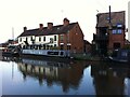
The Cape of Good Hope pub and neighbouring house, Grand Union Canal, Warwick
The Warwick & Napton Canal opened in 1800, connecting the Warwick & Birmingham Canal on the western side of Warwick with the Oxford Canal at Napton-on-the-Hill, east of Leamington and Southam. https://leamingtonhistory.co.uk/the-canal-at-royal-leamington-spa/ It now forms part of the Grand Union Canal. The Cape of Good Hope is a popular canalside pub on the north side of Warwick, which has given its name to the neighbourhood, known as the Cape.
Image: © A J Paxton
Taken: 29 May 2021
0.05 miles
9
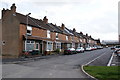
Missed by the wrecking ball
This group of traditional terraced housing managed to avoid being swept away in the current redevelopment of the Cape Road area of Warwick.
Image: © Colin Craig
Taken: 5 Apr 2009
0.06 miles
10
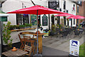
The Cape of Good Hope
Famous canalside pub by lock 25 on the Grand Union, ideal for watching the boating activity although the weather wasn't really conducive to sitting outside on this day.
Image: © Stephen McKay
Taken: 13 Aug 2015
0.06 miles