
IMAGES TAKEN NEAR TO
Saltisford, WARWICK, CV34 4TA
Introduction
This page details the photographs taken nearby to Saltisford, CV34 4TA by members of the Geograph project.
The Geograph project started in 2005 with the aim of publishing, organising and preserving representative images for every square kilometre of Great Britain, Ireland and the Isle of Man.

There are currently over 7.5m images from over14,400 individuals and you can help contribute to the project by visiting https://www.geograph.org.uk
Image Map
Images are licensed for reuse under creativecommons.org/licenses/by-sa/2.0
Notes
- Clicking on the map will re-center to the selected point.
- The higher the marker number, the further away the image location is from the centre of the postcode.
Image Listing (867 Images Found)
Images are licensed for reuse under creativecommons.org/licenses/by-sa/2.0
Image
Details
Distance
1
![Warwick houses [152]](https://s0.geograph.org.uk/geophotos/06/62/76/6627676_8331db55_120x120.jpg)
Warwick houses [152]
Numbers 18 and 20 Saltisford are late 16th or early 17th century timber framed with brick noggin. Listed, grade II, with details at: https://historicengland.org.uk/listing/the-list/list-entry/1035407
A market town and county town of Warwickshire, Warwick lies on the River Avon, 11 miles (18 kilometres) south of Coventry. There is evidence of unbroken habitation from the 6th century AD with signs of Neolithic and Roman activity before that date. It was a Saxon burh in the 9th century and Warwick Castle was built during the Norman Conquest. Much of the town was destroyed in The Great Fire of Warwick in 1694. Warwick Racecourse is located just west of the town centre. The Grand Union Canal passes through the town and the restored Saltisford Canal Arm is close to the town centre.
Image: © Michael Dibb
Taken: 6 Aug 2020
0.00 miles
2
![Warwick houses [153]](https://s2.geograph.org.uk/geophotos/06/62/81/6628166_64c02174_120x120.jpg)
Warwick houses [153]
Number 20 (Formerly 20A) Saltisford is late 16th or early 17th century timber framed. Listed, grade II, with details at: https://historicengland.org.uk/listing/the-list/list-entry/1364832
A market town and county town of Warwickshire, Warwick lies on the River Avon, 11 miles (18 kilometres) south of Coventry. There is evidence of unbroken habitation from the 6th century AD with signs of Neolithic and Roman activity before that date. It was a Saxon burh in the 9th century and Warwick Castle was built during the Norman Conquest. Much of the town was destroyed in The Great Fire of Warwick in 1694. Warwick Racecourse is located just west of the town centre. The Grand Union Canal passes through the town and the restored Saltisford Canal Arm is close to the town centre.
Image: © Michael Dibb
Taken: 6 Aug 2020
0.01 miles
3
![Warwick houses [154]](https://s3.geograph.org.uk/geophotos/06/62/81/6628167_0b89d5bd_120x120.jpg)
Warwick houses [154]
Numbers 22 and 24 Saltisford have been much altered recently with two former shop windows being replaced. The houses are late 16th or early 17th century timber framed with the front partly rebuilt in brick. Listed, grade II, with details at: https://historicengland.org.uk/listing/the-list/list-entry/1299805
A market town and county town of Warwickshire, Warwick lies on the River Avon, 11 miles (18 kilometres) south of Coventry. There is evidence of unbroken habitation from the 6th century AD with signs of Neolithic and Roman activity before that date. It was a Saxon burh in the 9th century and Warwick Castle was built during the Norman Conquest. Much of the town was destroyed in The Great Fire of Warwick in 1694. Warwick Racecourse is located just west of the town centre. The Grand Union Canal passes through the town and the restored Saltisford Canal Arm is close to the town centre.
Image: © Michael Dibb
Taken: 6 Aug 2020
0.02 miles
4
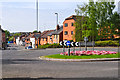
Warwick : Saltisford A425
A roundabout on the A425 in Warwick.
Image: © Lewis Clarke
Taken: 4 May 2014
0.02 miles
5
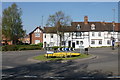
Roundabout on Saltisford
This roundabout governs access to the town centre from the north west of Warwick.
Image: © Bill Boaden
Taken: 19 Apr 2019
0.02 miles
6
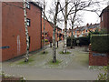
Closed south end of Edward Street, Warwick
With residential Victoria Street, Albert Street and Edward Street all joining Saltisford within a short distance, Edward Street was perhaps judged one too many as well as close to a roundabout so suffered to be closed. The silver birch trees have grown surprisingly vertical despite being near buildings.
Image: © Robin Stott
Taken: 22 Feb 2020
0.03 miles
8
![Warwick buildings [128]](https://s0.geograph.org.uk/geophotos/06/62/81/6628172_a60293ed_120x120.jpg)
Warwick buildings [128]
The Black Horse, number 62 Saltisford, is a long established coaching inn to which carriers continued to call until 1916.
A market town and county town of Warwickshire, Warwick lies on the River Avon, 11 miles (18 kilometres) south of Coventry. There is evidence of unbroken habitation from the 6th century AD with signs of Neolithic and Roman activity before that date. It was a Saxon burh in the 9th century and Warwick Castle was built during the Norman Conquest. Much of the town was destroyed in The Great Fire of Warwick in 1694. Warwick Racecourse is located just west of the town centre. The Grand Union Canal passes through the town and the restored Saltisford Canal Arm is close to the town centre.
Image: © Michael Dibb
Taken: 4 Aug 2020
0.04 miles
9
![Warwick features [16]](https://s2.geograph.org.uk/geophotos/06/62/81/6628174_c0e74961_120x120.jpg)
Warwick features [16]
A notice on the wall of the Black Horse Inn Image giving details of a local highwayman.
A market town and county town of Warwickshire, Warwick lies on the River Avon, 11 miles (18 kilometres) south of Coventry. There is evidence of unbroken habitation from the 6th century AD with signs of Neolithic and Roman activity before that date. It was a Saxon burh in the 9th century and Warwick Castle was built during the Norman Conquest. Much of the town was destroyed in The Great Fire of Warwick in 1694. Warwick Racecourse is located just west of the town centre. The Grand Union Canal passes through the town and the restored Saltisford Canal Arm is close to the town centre.
Image: © Michael Dibb
Taken: 4 Aug 2020
0.04 miles
10
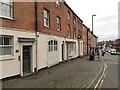
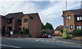
Refurbished frontages, Saltisford, Warwick
No 20 West Rock is on the left. Saltisford becomes the Birmingham Road, A4177, formerly the A41.
Image: © Robin Stott
Taken: 22 Feb 2020
0.04 miles