Closed south end of Edward Street, Warwick
Introduction
The photograph on this page of Closed south end of Edward Street, Warwick by Robin Stott as part of the Geograph project.
The Geograph project started in 2005 with the aim of publishing, organising and preserving representative images for every square kilometre of Great Britain, Ireland and the Isle of Man.

There are currently over 7.5m images from over 14,400 individuals and you can help contribute to the project by visiting https://www.geograph.org.uk
Closed south end of Edward Street, Warwick
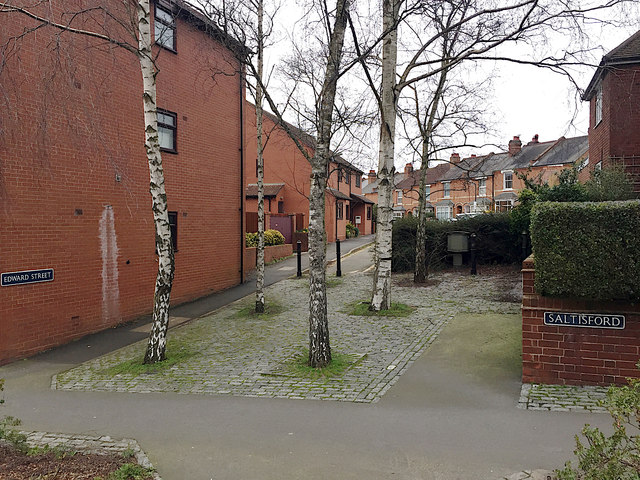
Image: © Robin Stott Taken: 22 Feb 2020
With residential Victoria Street, Albert Street and Edward Street all joining Saltisford within a short distance, Edward Street was perhaps judged one too many as well as close to a roundabout so suffered to be closed. The silver birch trees have grown surprisingly vertical despite being near buildings.
Images are licensed for reuse under creativecommons.org/licenses/by-sa/2.0
Image Location
Latitude
52.284054
Longitude
-1.59126