
IMAGES TAKEN NEAR TO
Crown Farm Close, COVENTRY, CV3 3JY
Introduction
This page details the photographs taken nearby to Crown Farm Close, CV3 3JY by members of the Geograph project.
The Geograph project started in 2005 with the aim of publishing, organising and preserving representative images for every square kilometre of Great Britain, Ireland and the Isle of Man.

There are currently over 7.5m images from over14,400 individuals and you can help contribute to the project by visiting https://www.geograph.org.uk
Image Map
Images are licensed for reuse under creativecommons.org/licenses/by-sa/2.0
Notes
- Clicking on the map will re-center to the selected point.
- The higher the marker number, the further away the image location is from the centre of the postcode.
Image Listing (14 Images Found)
Images are licensed for reuse under creativecommons.org/licenses/by-sa/2.0
Image
Details
Distance
1
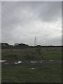
Willenhall, power lines
On a run from Pinley to Walsgrave, crossing Willenhall Wood and A46. This area of open land seems to suffer from its use with cars or motorbikes.
Image: © Mike Faherty
Taken: 21 Nov 2010
0.05 miles
2
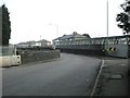
Willenhall-Saint James Lane
This side of the bridge is Saint James Lane and the other is Willenhall Lane Binley. Below is the Coventry-Rugby Line. The road here is quite narrow with a very sharp bend.
Image: © Ian Rob
Taken: 18 Mar 2009
0.12 miles
3
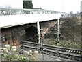
Willenhall-Saint James Lane Bridge
A footbridge was added to the road bridge which is barely wide enough for two cars.
Image: © Ian Rob
Taken: 18 Mar 2009
0.12 miles
4
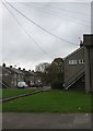
Willenhall, Bridgecote
Council housing development off Middle Ride.
Image: © Mike Faherty
Taken: 21 Nov 2010
0.15 miles
5
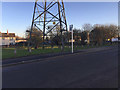
Open space with Pylon by Middle Ride, Willenhall, southeast Coventry
There are open spaces of one sort or another below the power lines, a wayleave for access.
Image: © Robin Stott
Taken: 5 Jan 2017
0.15 miles
6

Recreation Ground
Rugby posts on a pitch near Willenhall.
Image: © James Allan
Taken: 7 Jun 2014
0.15 miles
7
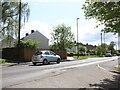
St James' Lane
View west along St James with the cul de sac of Bridgecote going off on the left and St James Court just visible in the near front foreground.
Image: © Nigel Mykura
Taken: 15 May 2023
0.16 miles
8
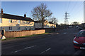
Middle Ride and power lines, Willenhall, southeast Coventry
Middle Ride – recalling a past landscape perhaps: http://www.coventrysociety.org.uk/coventry-neighbourhoods/willenhall.html
Image: © Robin Stott
Taken: 5 Jan 2017
0.17 miles
9
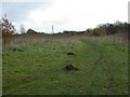
Willenhall, molehills
To the East of Willenhall Woods, in an area of grassland and scrub.
Image: © Mike Faherty
Taken: 21 Nov 2010
0.22 miles
10
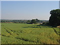
Willenhall
View looking south east across Brandon Grounds from the Coventry Eastern bypass as it crosses the square. The chimneys in the distance belong to the car plant beside the A45 at Ryton on Dunsmore.
Image: © David Stowell
Taken: 21 Jul 2005
0.22 miles