
IMAGES TAKEN NEAR TO
Ravens Flight, COVENTRY, CV3 3HY
Introduction
This page details the photographs taken nearby to Ravens Flight, CV3 3HY by members of the Geograph project.
The Geograph project started in 2005 with the aim of publishing, organising and preserving representative images for every square kilometre of Great Britain, Ireland and the Isle of Man.

There are currently over 7.5m images from over14,400 individuals and you can help contribute to the project by visiting https://www.geograph.org.uk
Image Map
Images are licensed for reuse under creativecommons.org/licenses/by-sa/2.0
Notes
- Clicking on the map will re-center to the selected point.
- The higher the marker number, the further away the image location is from the centre of the postcode.
Image Listing (17 Images Found)
Images are licensed for reuse under creativecommons.org/licenses/by-sa/2.0
Image
Details
Distance
1
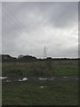
Willenhall, power lines
On a run from Pinley to Walsgrave, crossing Willenhall Wood and A46. This area of open land seems to suffer from its use with cars or motorbikes.
Image: © Mike Faherty
Taken: 21 Nov 2010
0.08 miles
2
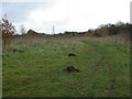
Willenhall, molehills
To the East of Willenhall Woods, in an area of grassland and scrub.
Image: © Mike Faherty
Taken: 21 Nov 2010
0.08 miles
4
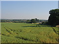
Willenhall
View looking south east across Brandon Grounds from the Coventry Eastern bypass as it crosses the square. The chimneys in the distance belong to the car plant beside the A45 at Ryton on Dunsmore.
Image: © David Stowell
Taken: 21 Jul 2005
0.11 miles
5
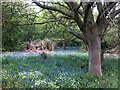
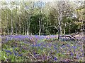
Clearing with bluebells, Willenhall Wood
Modern Coventry is built over part of Arden, the northwestern half of Warwickshire, characterised by ancient countryside with extensive woodland, ancient hedges, scattered hamlets and winding lanes with hollow ways. It was never a 'Forest of Arden', and much of the woodland had been cleared by the 13th century (see Oliver Rackham, The New Naturalist Library: Woodlands, Collins, 2006). But many woods survive, and we are fortunate that some were incorporated in to the suburbs of Coventry when the city expanded rapidly after the second world war. Willenhall Wood is one example.
Image: © A J Paxton
Taken: 4 May 2019
0.12 miles
6
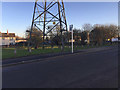
Open space with Pylon by Middle Ride, Willenhall, southeast Coventry
There are open spaces of one sort or another below the power lines, a wayleave for access.
Image: © Robin Stott
Taken: 5 Jan 2017
0.13 miles
7
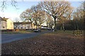
Middle Ride by Willenhall Wood, Willenhall, southeast Coventry
There is a large play area behind the camera. Willenhall Wood is owned by Coventry City Council and managed as a nature reserve. Traffic noise could be heard from the A45 to the south.
Image: © Robin Stott
Taken: 5 Jan 2017
0.14 miles
8
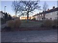
Open space off Middle Ride, Willenhall, southeast Coventry
A view into the Middle Ride estate framed by terraces of houses in Marlcroft, left, and Harcourt, right. The oak tree is one of many that have been retained in Willenhall.
Image: © Robin Stott
Taken: 5 Jan 2017
0.15 miles
9
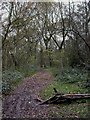
Willenhall Wood, footpath
Through oak woodland at Willenhall Wood Local Nature Reserve. http://www.coventry-walks.org.uk/nature-areas.html
Image: © Mike Faherty
Taken: 21 Nov 2010
0.16 miles
10
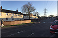
Middle Ride and power lines, Willenhall, southeast Coventry
Middle Ride – recalling a past landscape perhaps: http://www.coventrysociety.org.uk/coventry-neighbourhoods/willenhall.html
Image: © Robin Stott
Taken: 5 Jan 2017
0.18 miles