
IMAGES TAKEN NEAR TO
St. Judes Crescent, COVENTRY, CV3 3HA
Introduction
This page details the photographs taken nearby to St. Judes Crescent, CV3 3HA by members of the Geograph project.
The Geograph project started in 2005 with the aim of publishing, organising and preserving representative images for every square kilometre of Great Britain, Ireland and the Isle of Man.

There are currently over 7.5m images from over14,400 individuals and you can help contribute to the project by visiting https://www.geograph.org.uk
Image Map
Images are licensed for reuse under creativecommons.org/licenses/by-sa/2.0
Notes
- Clicking on the map will re-center to the selected point.
- The higher the marker number, the further away the image location is from the centre of the postcode.
Image Listing (9 Images Found)
Images are licensed for reuse under creativecommons.org/licenses/by-sa/2.0
Image
Details
Distance
1
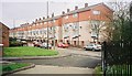
Tarquin Close, Willenhall, Coventry
Formerly known as Ivy Walk.
Image: © A J Paxton
Taken: Unknown
0.06 miles
2
Mary Slessor Street, Willenhall, southeast Coventry
Image: © Robin Stott
Taken: 5 Jan 2017
0.10 miles
3
Lorenzo Close, Willenhall, southeast Coventry
Image: © Robin Stott
Taken: 5 Jan 2017
0.11 miles
4
East on Remembrance Road, Willenhall, southeast Coventry
Image: © Robin Stott
Taken: 5 Jan 2017
0.16 miles
5
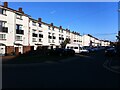
Return to Tarquin Close
Another old geograph revisited, and viewed from the opposite end this time; see Image The blocks of Tarquin Close have had a revamp since then, with the addition of external insulating cladding that was installed on much of Coventry's social housing stock in the years around 2014: see Image Once known as Ivy Walk, this long row of four-storey blocks of flats is very visible from the London to Coventry railway, which runs behind them.
Image: © A J Paxton
Taken: 8 Oct 2022
0.17 miles
6
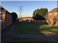
Power lines over Potton Close, Willenhall, southeast Coventry
Image: © Robin Stott
Taken: 5 Jan 2017
0.17 miles
7
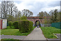
Railway bridge over a footpath, Willenhall, southeast Coventry
A baby compared to the massive viaducts over the rivers Sowe and Sherbourne https://www.geograph.org.uk/snippet/19354 but showing a family likeness. It was built to carry the London and Birmingham Railway, which opened in 1838 here. The view is from Tarquin Close, Willenhall. The path (which preceded the railway) leads to schools and Langbank Avenue on the south side of Binley.
Image: © Robin Stott
Taken: 27 Apr 2016
0.18 miles
8
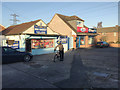
St James' Lane Mini Market, Hello! Chicken and Happy Cod, Willenhall, southeast Coventry
Image: © Robin Stott
Taken: 5 Jan 2017
0.21 miles
9
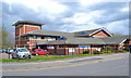
Primary Care Centre and Dental Surgery, Willenhall, southeast Coventry
Signs say 'Coventry NHS / Willenhall Primary Care Centre' and 'Willenhall Dental Surgery', and 'Willenhall Dental Care' with an NHS logo, on the single-storey building. The address is Remembrance Road, out of shot left; this view is across Robin Hood Road on a sunny April lunchtime. The Primary Care Centre may well replace the facility that was on a site in Stretton Avenue: to the right in Image
Image: © Robin Stott
Taken: 27 Apr 2016
0.24 miles