
IMAGES TAKEN NEAR TO
Mayan Close, LEAMINGTON SPA, CV33 9WU
Introduction
This page details the photographs taken nearby to Mayan Close, CV33 9WU by members of the Geograph project.
The Geograph project started in 2005 with the aim of publishing, organising and preserving representative images for every square kilometre of Great Britain, Ireland and the Isle of Man.

There are currently over 7.5m images from over14,400 individuals and you can help contribute to the project by visiting https://www.geograph.org.uk
Image Map
Images are licensed for reuse under creativecommons.org/licenses/by-sa/2.0
Notes
- Clicking on the map will re-center to the selected point.
- The higher the marker number, the further away the image location is from the centre of the postcode.
Image Listing (26 Images Found)
Images are licensed for reuse under creativecommons.org/licenses/by-sa/2.0
Image
Details
Distance
1
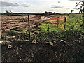
Groundworks at Grove Farm off Harbury Lane, south Leamington
One of several sites being developed for housing on the south side of Harbury Lane. A road is being laid out.
Image: © Robin Stott
Taken: 10 Apr 2017
0.08 miles
2
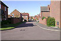
Trinculo Grove, Warwick Gates estate
In places the developers have contrived a villagey feel to the Warwick Gates estate, as here, but it's too neat and tidy, too sterile to be convincing. To be fair, the estate is pretty full, with all sorts of people and there's lots of life going on.
Image: © Robin Stott
Taken: 11 Aug 2009
0.09 miles
3
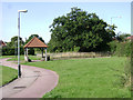
The Whitnash Oak, Warwick Gates estate
An ancient tree on the parish boundary, it finds itself treated as a feature in a housing estate but manages to keep its dignity.
Image: © Robin Stott
Taken: 11 Aug 2009
0.10 miles
4
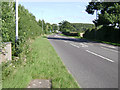
Harbury Lane by Warwick Gates estate
Seen from the corner of Cicero Approach. The identity of this area is in flux. The gazetteer says 'near to Whitnash', which is true, but this corner of Warwick Gates is in the parish of Bishop's Tachbrook, the village to the south. The name Warwick Gates creates an association with Warwick's heritage but the whole estate feels like a further extension of south Leamington. Politically, though, most of the estate is in the Warwick South ward.
Image: © Robin Stott
Taken: 11 Aug 2009
0.10 miles
5
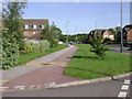
South end of Othello Avenue, Warwick Gates estate
Seen from the corner of Banquo Approach. Almost all the streets on the estate are named after characters from Shakespeare's plays. Touchstone Road joins, right.
Image: © Robin Stott
Taken: 11 Aug 2009
0.11 miles
6
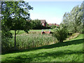
Surface water holding lagoon, Warwick Gates estate
There are four such lagoons, one at each corner of the estate. They appear too deep, as though the engineers have overdone the safety factors. Still, better safe than sorry.
Image: © Robin Stott
Taken: 11 Aug 2009
0.11 miles
7
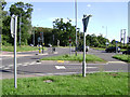
Junction of Harbury Lane and Tachbrook Road
This is almost the reverse view to: Image When the Warwick Gates estate was planned, land was reserved for a remodelled junction here: a roundabout in all probability. It hasn't happened.
Image: © Robin Stott
Taken: 11 Aug 2009
0.12 miles
8
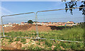
New residential development south of Harbury Lane, Heathcote, south Leamington
For years the south side of Harbury Lane had a couple of farms and a long-established static caravan site, Heathcote Park Image Planning permission was granted to Gallagher for a business and industrial estate near Europa Way, route to the M40, but it was never implemented. In recent years a number of housing developments have appeared and more are being built. The view is from the new road that will access a site at Grove Farm: Bishops Gate? Oakley Grove? Meadowsweet Farm?
Image: © Robin Stott
Taken: 3 Jun 2018
0.13 miles
9
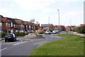
New housing near Warwick
Estates of houses like these have sprung up in recent years around Warwick, covering previously green fields with concrete.
Image: © Colin Craig
Taken: 29 Mar 2009
0.13 miles
10
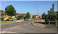
Junction of Banquo Approach and Othello Avenue, Heathcote, south Leamington
Othello Avenue is one of the main arteries of the Warwick Gates estate. All the roads are named after characters from Shakespeare's works.
Image: © Robin Stott
Taken: 3 Jun 2018
0.13 miles