IMAGES TAKEN NEAR TO
The Avenue, LEAMINGTON SPA, CV33 9DJ
Introduction
This page details the photographs taken nearby to The Avenue, CV33 9DJ by members of the Geograph project.
The Geograph project started in 2005 with the aim of publishing, organising and preserving representative images for every square kilometre of Great Britain, Ireland and the Isle of Man.

There are currently over 7.5m images from over14,400 individuals and you can help contribute to the project by visiting https://www.geograph.org.uk
Image Map
Images are licensed for reuse under creativecommons.org/licenses/by-sa/2.0
Notes
- Clicking on the map will re-center to the selected point.
- The higher the marker number, the further away the image location is from the centre of the postcode.
Image Listing (10 Images Found)
Images are licensed for reuse under creativecommons.org/licenses/by-sa/2.0
Image
Details
Distance
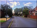
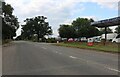
1
Bitham Road, Lighthorne Heath
Lighthorne Heath was mainly constructed to house the officers and men operating the adjacent airfield at Gaydon. The airfield has closed and the services have moved out so the village is now a civilian village. This northern part is more secluded and was used to house the officers. The American Air force used the ex-officer houses before they were sold to private individuals.
Image: © David Stowell
Taken: 23 Dec 2005
0.17 miles
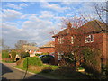
2
Lighthorne Heath
At the northern edge of this former Air Forces village associated with Gaydon airfield. This area is rather more secluded than much of the village - compare with Image
Image: © David Stowell
Taken: 23 Dec 2005
0.17 miles
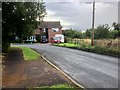
5
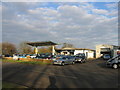
Lighthorne Heath Filling Station
Beside what used to be the A41 Warwick - Banbury trunk road. With the coming of the nearby M40 and competition from supermarkets etc. this is no longer a filling station but they still carry out car maintenance and deal in second hand vehicles.
Image: © David Stowell
Taken: 23 Dec 2005
0.23 miles
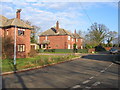
6
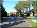
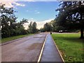
Leam Road, Lighthorne Heath
Looking north up Leam Road towards the junction with Winyates Road. Bitham Road is straight ahead.
Image: © David P Howard
Taken: 17 Oct 2010
0.23 miles
7
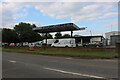
Lighthorne Motor Company on Banbury Road
Image: © David Howard
Taken: 1 Aug 2021
0.23 miles
9
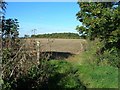
Bridleway to Checkleys Brake
Looking north along the bridleway from Lighthorne Heath towards the trees in the distance which are called Checkleys Brake. The building of the M40 motorway has caused this bridleway to turn sharp left along the fenceline in the middle distance, beyond which is the motorway. A farm bridge has been built which also carries the bridleway over the motorway. The noise of the traffic can already be heard quite loudly even at this distance, about 250 metres.
Image: © David P Howard
Taken: 17 Oct 2010
0.24 miles