
IMAGES TAKEN NEAR TO
Langbank Avenue, COVENTRY, CV3 2PN
Introduction
This page details the photographs taken nearby to Langbank Avenue, CV3 2PN by members of the Geograph project.
The Geograph project started in 2005 with the aim of publishing, organising and preserving representative images for every square kilometre of Great Britain, Ireland and the Isle of Man.

There are currently over 7.5m images from over14,400 individuals and you can help contribute to the project by visiting https://www.geograph.org.uk
Image Map
Images are licensed for reuse under creativecommons.org/licenses/by-sa/2.0
Notes
- Clicking on the map will re-center to the selected point.
- The higher the marker number, the further away the image location is from the centre of the postcode.
Image Listing (19 Images Found)
Images are licensed for reuse under creativecommons.org/licenses/by-sa/2.0
Image
Details
Distance
1
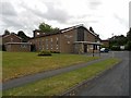
Corpus Christi Roman Catholic Church
On Langbank Avenue, dating from 1953.
Image: © Ian Rob
Taken: 28 Jul 2013
0.05 miles
2
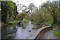
River Sowe immediately upstream from the railway viaduct, Willenhall, Coventry
Image: © Robin Stott
Taken: 27 Apr 2016
0.15 miles
3
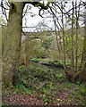
Banks of the River Sowe north of the railway viaduct, Coventry
A local train is crossing.
Image: © Robin Stott
Taken: 27 Apr 2016
0.15 miles
4
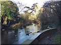
River Sowe beneath Sowe Viaduct, southeast Coventry
Looking upstream on a sunny morning a few days before Christmas. The impressive Sowe Viaduct carries the main railway line east of Coventry. On its high embankment it forms a massive physical boundary between the suburbs of Willenhall, behind the camera, and Binley. The water's edge is a slight detour from the Sowe Valley Footpath.
Image: © Robin Stott
Taken: 22 Dec 2016
0.15 miles
5
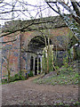
Side arches, east side of railway viaduct over the River Sowe, Willenhall, Coventry
As the Historic England listing notes, there are many repairs in blue engineering brick. It makes one wonder about the quality of the original brick used.
Image: © Robin Stott
Taken: 27 Apr 2016
0.15 miles
6
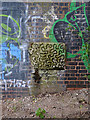
Retained stone dressing, Sowe railway viaduct, Willenhall, southeast Coventry
It may be that in the course of repairs to, or replacement of the original (orange) brickwork, this piece of the stone dressings was retained. See Image The extent of repairs to this and the closely similar viaduct over the Sherbourne https://www.geograph.org.uk/snippet/19354 might give cause for concern.
Image: © Robin Stott
Taken: 27 Apr 2016
0.15 miles
7
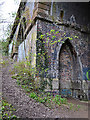
Corner of side arch, railway viaduct over the River Sowe, Willenhall, southeast Coventry
On the right is one of the "smaller pointed arches with blind panels" referred to in the listing, seen also in Image They give tremendous, even creepy, character to the side arches.
Image: © Robin Stott
Taken: 27 Apr 2016
0.15 miles
8
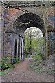
Accessible side arch, railway viaduct over the Sowe, Willenhall, southeast Coventry
Image: © Robin Stott
Taken: 27 Apr 2016
0.16 miles
9
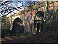
Sowe Viaduct, Willenhall, southeast Coventry
This splendid structure carries the main railway line over the River Sowe on the east side of Coventry. Historic England records: "The Sowe Viaduct, completed in 1838, is listed at Grade II for the following principal reasons:
Date: an early example of a viaduct dating from the pioneering phase of railway development;
Architectural and engineering interest: the viaduct is well detailed and shows a skilful handling of the engineering challenge of crossing the River Sowe;
Historic interest: designed by Robert Stephenson, one of the most important transport engineers of the C19."
Railway history and more at https://www.historicengland.org.uk/listing/the-list/list-entry/1431088
Image: © Robin Stott
Taken: 22 Dec 2016
0.16 miles
10
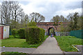
Railway bridge over a footpath, Willenhall, southeast Coventry
A baby compared to the massive viaducts over the rivers Sowe and Sherbourne https://www.geograph.org.uk/snippet/19354 but showing a family likeness. It was built to carry the London and Birmingham Railway, which opened in 1838 here. The view is from Tarquin Close, Willenhall. The path (which preceded the railway) leads to schools and Langbank Avenue on the south side of Binley.
Image: © Robin Stott
Taken: 27 Apr 2016
0.16 miles